Skip to content

Navigation Menu

Sign in
Appearance settings

Search code, repositories, users, issues, pull requests...

Provide feedback

We read every piece of feedback, and take your input very seriously.

Saved searches

Use saved searches to filter your results more quickly

Sign up
Appearance settings

App for Nextcloud, that shows geotagged photos on a map

License

Notifications You must be signed in to change notification settings

BatPio/PhotoMap

Repository files navigation

Photo Map

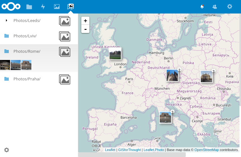
Shows geotagged photos on map

screenshot1

Building the app

The app can be built by using the provided Makefile by running:

make

This requires the following things to be present:

  • make
  • which
  • tar: for building the archive
  • curl: used if phpunit and composer are not installed to fetch them from the web
  • npm: for building and testing JS

Publish to App Store

First get an account for the App Store then run:

make && make appstore

The archive is located in build/artifacts/appstore and can then be uploaded to the App Store.

About

App for Nextcloud, that shows geotagged photos on a map

Topics

Resources

License

Stars

Watchers

Forks

Releases

No releases published

Packages

No packages published

AltStyle によって変換されたページ (->オリジナル) /