I have a shapefile layer with locations of dead birds, their total number is about 180, the locations where they were found are about 70. The shapefile contains the Latin name of each of the birds, as well as the order to which the bird belongs, as well as the X and Y coordinates of the location each of the birds is found. I want to create a pie chart for each of the locations showing the number and order to which the found birds belong.
I am attaching an image of the result I want to achieve: enter image description here
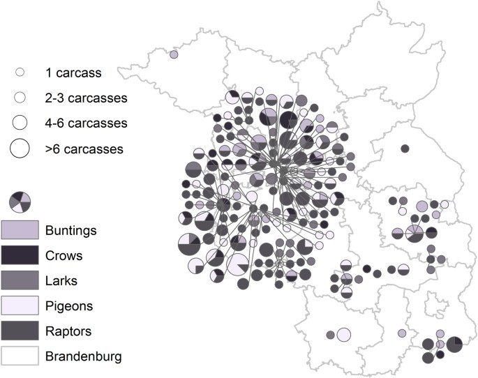
as well as a sample of the data I have:
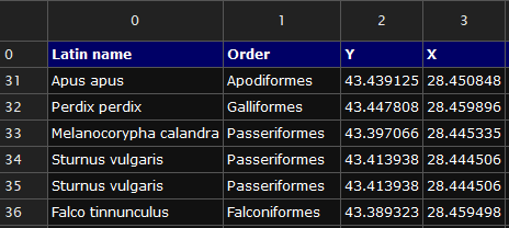
I tried the charts in QGIS, but as far as I understand it only works with numeric values. With the "Statistic by Categories" tool, I was able to retrieve the total number of victims for each of the locations, but I can't seem to get a handle on the order they belong to. I don't know if I'm even on the right way with "Statistic by Categories".
1 Answer 1
Reformatting the attribute table by merging with the similar location field and creating different fields for each numeric feature that you want to show on pie chart should help.
With this data structure, it can be easily represented as pie chart through Layer Properties >Diagrams > Pie Chart.
-
That's exactly what I did. I made a new table with each row representing each individual location and columns for the respective bird orders. For each location I scored 0 or 1 for the presence or absence of a find. In the end, I got the result I expected. Thanks.Nikolay Yordanov– Nikolay Yordanov2024年02月17日 08:38:43 +00:00Commented Feb 17, 2024 at 8:38