Background:
Our local newspaper contained this link to some upcoming forest management activity in the area:
https://usfs.maps.arcgis.com/apps/webappviewer/index.html?id=021ff3371f584a54beb15cd481a8fbb5
Here's a screenshot of the resulting argis.com webmap:
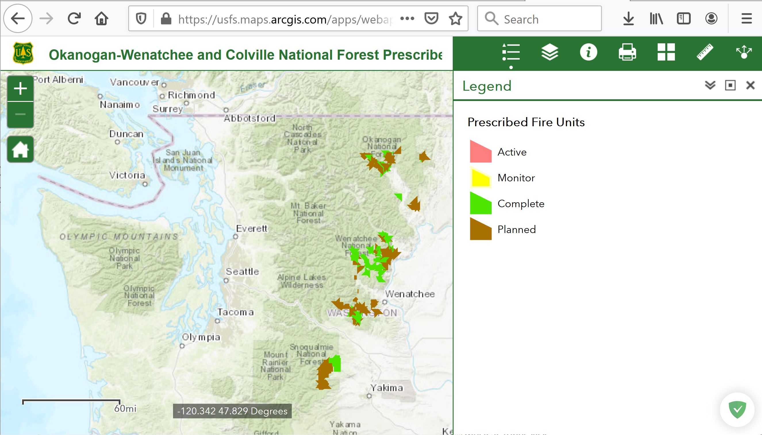
Problem:
I would like access the prescribed fire polygon layer displayed in this webmap, either as a service or via download. However, I'm unable to accomplish this seemingly simple task. Here's what I've unsuccessfully tried:
- Look for some sort of link (service url or layer download) in the webmap itself
- Search for the polygon layer via my personal arcgis.com account. Here my steps were to create a new map and search using Add > Search for Layers, Add > Browse Living Atlas Layers, and Add > Add Layer From Web.
- From ArcMap (10.8.1), Add > Add Data from ArcGIS Online and search
Question:
How do I access the polygon layer in this webmap?
1 Answer 1
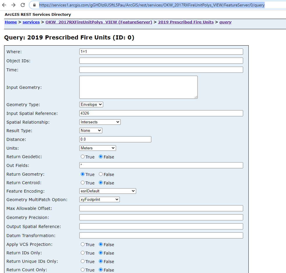
To get the data in GeoJSON use the long url
https://services1.arcgis.com/gGHDlz6USftL5Pau/ArcGIS/rest/services/OKW_2017RXFireUnitPolys_VIEW/FeatureServer/0/query?where=1%3D1&objectIds=&time=&geometry=&geometryType=esriGeometryEnvelope&inSR=4326&spatialRel=esriSpatialRelIntersects&resultType=none&distance=0.0&units=esriSRUnit_Meter&returnGeodetic=false&outFields=*&returnGeometry=true&returnCentroid=false&featureEncoding=esriDefault&multipatchOption=xyFootprint&maxAllowableOffset=&geometryPrecision=&outSR=&datumTransformation=&applyVCSProjection=false&returnIdsOnly=false&returnUniqueIdsOnly=false&returnCountOnly=false&returnExtentOnly=false&returnQueryGeometry=false&returnDistinctValues=false&cacheHint=false&orderByFields=&groupByFieldsForStatistics=&outStatistics=&having=&resultOffset=&resultRecordCount=&returnZ=false&returnM=false&returnExceededLimitFeatures=true&quantizationParameters=&sqlFormat=none&f=pgeojson&token=
This can be done from the query wizard here https://services1.arcgis.com/gGHDlz6USftL5Pau/ArcGIS/rest/services/OKW_2017RXFireUnitPolys_VIEW/FeatureServer/0/query
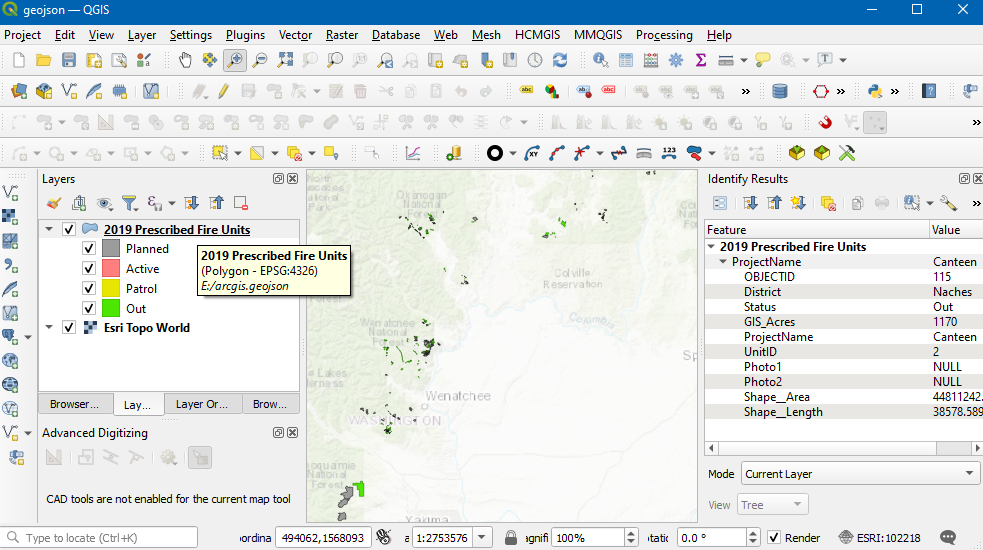
(in QGIS this will load with drag and drop) but your looking for ArcGIS. When in the Office next year can validate. screenshot shows the data in geojson/styled as the map legend. enter image description here
Explore related questions
See similar questions with these tags.
networktab (right click in a webpage, inspect/dev tools, network)