My code is generating coordinates (Lat, Lon) of 1000 houses. Now I want to reverse these 1000 coordinates to get the full address. The code is:
import pprint
from arcgis.geocoding import reverse_geocode
Houses = [0]*(1000)
Houses[0], Houses[1] = (143.5689855, -38.328956999999996), (143.5692555, -38.328993)
for i in range(2, 1000):
 latitude_diff = Houses[i-1][0] - Houses[i-2][0]
 longitude_diff= Houses[i-1][1] - Houses[i-2][1]
 temp = (Houses[i-1][0]+latitude_diff, Houses[i-1][1]+longitude_diff)
 Houses[i] = temp
pprint.pprint(Houses)
I tried reverse_geocode() from ArcGIS API for Python but it only converts single coordinate like below:
results = reverse_geocode([143.5689855, -38.328956999999996])
How can I reverse the coordinates of 1000 houses into full addresses?
1 Answer 1
Your error was probably similar to this one
Traceback (most recent call last):
 File "D:/test.py", line 24, in <module>
 results = reverse_geocode(pt)
 File "C:\...\_functions.py", line 1054, in reverse_geocode
 geocoder = arcgis.env.active_gis._tools.geocoders[0]
AttributeError: 'NoneType' object has no attribute '_tools'
It is most likely because of the credentials that have to be specified gis = GIS("http://www.arcgis.com", "username", "password").
Otherwise, I would doubt that ArcGIS libraries could be deployed without a license.
So, the final code will look as follows (including comments)
import csv
from arcgis.gis import GIS
from arcgis.geometry import Geometry
from arcgis.geocoding import reverse_geocode
gis = GIS("http://www.arcgis.com", "***", "***")
houses = []
houses.append((143.5689855, -38.328956999999996))
houses.append((143.5692555, -38.328993000000000))
lat_diff = houses[1][0] - houses[0][0]
lon_diff = houses[1][1] - houses[0][1]
i = 1
while i <= 5:
 houses.append((houses[i][0] + lat_diff, houses[i][1] + lon_diff))
 i = i + 1
result = []
for x, y in houses:
 pt = Geometry({
 "x": float(x),
 "y": float(y),
 "spatialReference": {
 "wkid": 4326
 }
 })
 try:
 result.append(reverse_geocode(pt))
 except:
 pass
i = 0
result_to_csv = []
for item in result:
 i += 1
 result_item = {
 'id': i,
 'address': item['address']['LongLabel'],
 'lat': round(item['location']['x'],6),
 'lon': round(item['location']['y'],6)
 }
 result_to_csv.append(result_item)
keys = result_to_csv[0].keys()
with open('output.csv', 'w', encoding='utf8', newline='') as output_file:
 dict_writer = csv.DictWriter(output_file, keys, delimiter=';', quoting=csv.QUOTE_NONE, lineterminator='\r')
 dict_writer.writeheader()
 dict_writer.writerows(result_to_csv)
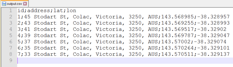
The output CSV-file
when 1.000 of houses have to be geocoded then adjust this part while i < 999.
-
@Thank you for great results. Can we save the above results to
.CSV?. For instance: The first column give us address and 2nd column give us latitude,Latitude.Case Msee– Case Msee2020年03月25日 01:49:34 +00:00Commented Mar 25, 2020 at 1:49
Explore related questions
See similar questions with these tags.