I wrote a quick script to automate the intersect geoprocessing. There are 2 inputs, Polyline A & Polyline B, and 1 output- a point file with XY where the two lines intersect. Problem is if the fist input line (A) crosses the second input line(B) twice, it creates 2 points but "merges" them in the output table. The XY calculated thus, is halfway between these two points. What I am looking for is 2 seperate points in the output table with correct XY. (I tried it with manual intersect tool from toolbox and it does the same thing)
1 Answer 1
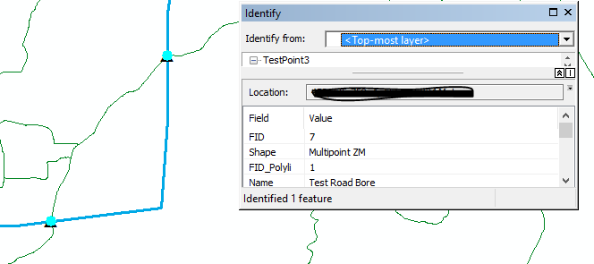
The problem here is that the output is a multipoint layer, in which multiple points can be part of the same feature.
Look in Data Management Tools> Features> Multipart To Singlepart, and run that with your points layer as the input.
You should be able to calculate accurate xy coordinates for your points now. I'm not well-versed in arcpy, but I would imagine that the multi-to-single algorithm could be easily incorporated into your script.