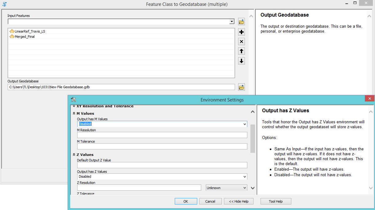
I want to remove the M and Z values of the shapefiles, which can be done by using Feature Class to Geodatabase (multiple) and choosing Disabled for M and Z values. The following picture shows the details of the step. enter image description here
I want to use arcpy to realize this step so I used Copy As Python Snippet and obtained the below code.
arcpy.FeatureClassToGeodatabase_conversion(Input_Features="LinearRef_Travis_LS;Merged_Final", Output_Geodatabase="C:/Users/TL/Desktop/1031/New File Geodatabase.gdb")
The code doesn't show the part of changing the environment setting. I wonder if there is way to remove the M and Z values of shapefiles by using arcpy?
I am using ArcGIS Desktop 10.3.1 Advanced License.
1 Answer 1
There aren't any settings in the tool that allow you to set the environment. However, looking at the documentation for this tool, you can see that the environments for M and Z values are honoured.
Prior to running your tool, set the appropriate environment settings as such:
import arcpy
# Set the outputMFlag environment to Disabled
arcpy.env.outputMFlag = "Disabled"
# Set the outputZFlag environment to Disabled
arcpy.env.outputZFlag = "Disabled"
Then you can run your code to convert the feature class:
arcpy.FeatureClassToGeodatabase_conversion(Input_Features="LinearRef_Travis_LS;Merged_Final", Output_Geodatabase="C:/Users/TL/Desktop/1031/New File Geodatabase.gdb")
Here's the documentation on the "Output has M Values" flag and here's the documentation on the "Output has Z Values" flag.
Explore related questions
See similar questions with these tags.