I am using ArcGIS 9.3.
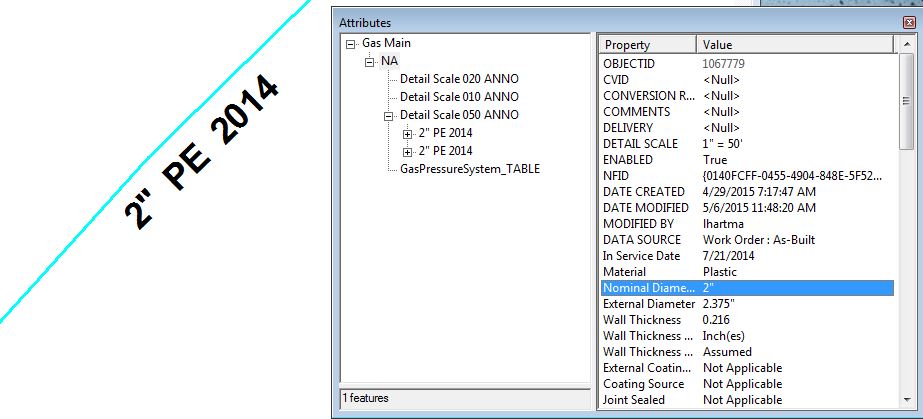
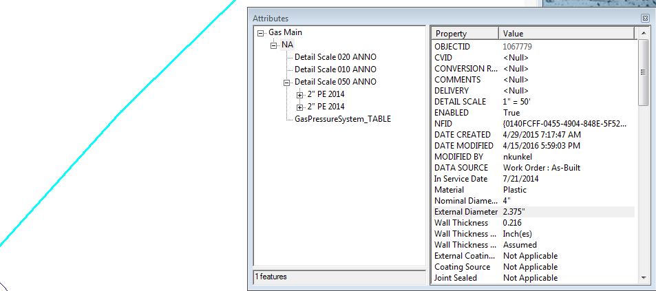
I have a copy of an original SDE database with feature classes, annotations, and relationship classes for those annotations. The copied geodatabase is an exact replica of an ArcSDE database called PRDGIS.SDE. Versions of this database are copied automatically overnight by python script and preserved for about a month, then deleted. The most recent version from our SDEarchive folder was pulled for this test. Relationship classes and topologies were removed. A geometric network was then created. Using the blueprints of the original relationship classes, I re-created the relationship classes for all annotations after the network was built. I am testing to see if the features are linked as well as the annotations. Everything is linked up correctly (the right annotations belong to the right features), however, when I attempt to update attribute information for a feature and have the annotation reflect that change, the annotation simply disappears. The annotations were related by a composite, forward direction, one to many relationship. Editing the nominal diameter field Annotation disappears
-
2Please edit the question to specify the database (with version) in which your enterprise geodatabase resides. It is also important to specify the exact procedure you used to "copy" the geodatabase. ArcGIS 9.3 was retired sixteen months ago. It wasn't supported on any database which is currently actively supported, or on an operating system which is currently supported, so reproducing the issue is going to be a challenge.Vince– Vince2016年04月15日 22:21:24 +00:00Commented Apr 15, 2016 at 22:21
1 Answer 1
Esri indicates that edits made outside of the existing geodatabase tools could result in unexpected behavior.
"When a composite relationship is established between two objects, as in the case of feature-linked annotation, any modifications made to those objects using ArcGIS applications and the geodatabase API will ensure the relationship between the features and the annotation is always maintained."...
"However, as any edit operation undertaken using SQL will bypass these geodatabase constraints and data integrity rules and will not respect the relationships between feature classes, the potential impact of such an operation should be considered carefully prior to making any changes."
see page 6 in this link: http://downloads.esri.com/support/whitepapers/sde_/GeodatabaseUsingSQL_2_30mar06.pdf
Explore related questions
See similar questions with these tags.