Cell phone-based system (Chaak) for surveillance of immatures of dengue virus mosquito vectors
- PMID: 23926788
- PMCID: PMC3929104
- DOI: 10.1603/me13008
Cell phone-based system (Chaak) for surveillance of immatures of dengue virus mosquito vectors
Abstract
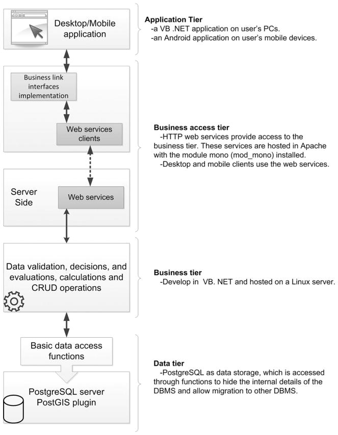
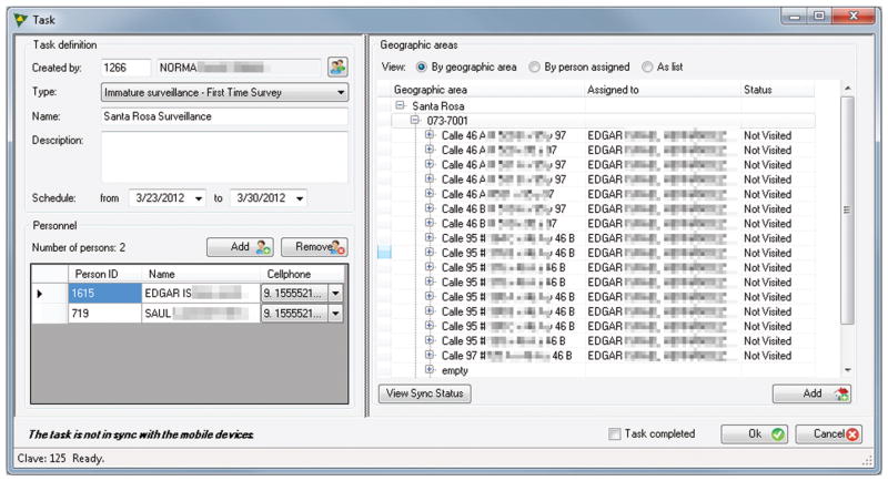
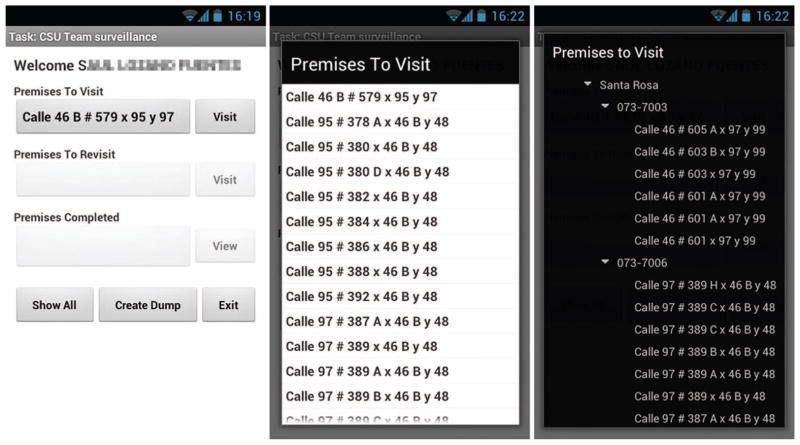
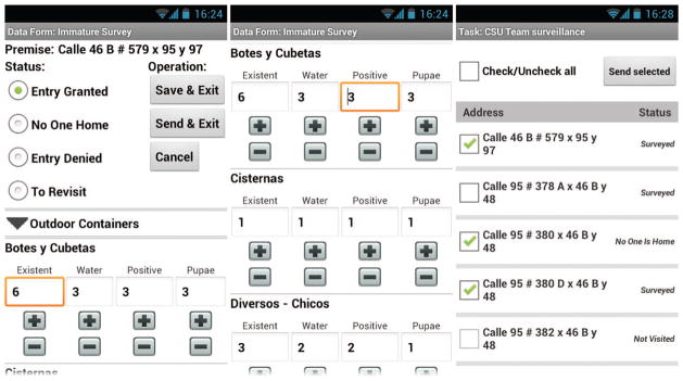
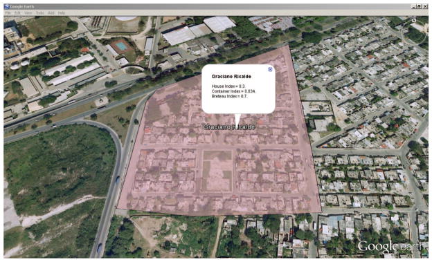
Capture of surveillance data on mobile devices and rapid transfer of such data from these devices into an electronic database or data management and decision support systems promote timely data analyses and public health response during disease outbreaks. Mobile data capture is used increasingly for malaria surveillance and holds great promise for surveillance of other neglected tropical diseases. We focused on mosquito-borne dengue, with the primary aims of: 1) developing and field-testing a cell phone-based system (called Chaak) for capture of data relating to the surveillance of the mosquito immature stages, and 2) assessing, in the dengue endemic setting of Mérida, Mexico, the cost-effectiveness of this new technology versus paper-based data collection. Chaak includes a desktop component, where a manager selects premises to be surveyed for mosquito immatures, and a cell phone component, where the surveyor receives the assigned tasks and captures the data. Data collected on the cell phone can be transferred to a central database through different modes of transmission, including near-real time where data are transferred immediately (e.g., over the Internet) or by first storing data on the cell phone for future transmission. Spatial data are handled in a novel, semantically driven, geographic information system. Compared with a pen-and-paper-based method, use of Chaak improved the accuracy and increased the speed of data transcription into an electronic database. The cost-effectiveness of using the Chaak system will depend largely on the up-front cost of purchasing cell phones and the recurring cost of data transfer over a cellular network.
Figures
References
-
- Adedeji AA, Sanusi B, Tella A, Akinsanya M, Ojo O, Akinwunmi MO, Tikare OA, Ogunwande IA, Ogundahunsi OA, Ayilara OO, et al. Exposure to anti-malarial drugs and monitoring of adverse drug reactions using toll-free mobile phone calls in private retail sector in Sagamu, Nigeria: implications for pharmacovigilance. Malar J. 2011;10:230. - PMC - PubMed
-
- Android. Android operating system. 2012 ( http://www.android.com/)
-
- Apache-Tomcat. The Tomcat project. 2012 ( http://tomcat.apache.org/)
-
- Aviles W, Ortega O, Kuan G, Coloma J, Harris E. Quantitative assessment of the benefits of specific information technologies applied to clinical studies in developing countries. Am J Trop Med Hyg. 2008;78:311–315. - PubMed
Publication types
MeSH terms
Grants and funding
LinkOut - more resources
Full Text Sources
Other Literature Sources
Medical