Saturday, April 23, 2022
Getting into Grade Three
No, I'm not at school anymore, though I'm yet to stop learning new things, on a daily basis if possible. In this case the topic refers to my ongoing journey in tackling whitewater paddling with my packraft.
When I first purchased my packraft back in 2019 I had simple goals. My purpose was to use a packraft to make a tramp a bit more interesting. To not be deterred by a lake or simple waterway but to use my portable craft to continue on.
Because of my double winters skiing, I'd not yet met many packrafting people in NZ. The annual NZ meetup happened in January, when I was in the Northern Hemisphere, but I'd been keeping an eye on things from the sidelines. I felt that the emphasis seemed to be too strongly focused on paddling whitewater, and after getting caught on a tree on my first packrafting outing with Arno I was less than eager to go anywhere near rapids higher than Grade 2, EVER!!!
Due to COVID I've been stuck in NZ for a couple of summers, so at last got to attend some packrafting meetups and begin to make friends and contacts within the relatively small packrafting community. My first meetup didn't really give me much confidence, tending to reinforce my initial prejudices about it's whitewater focus, but slowly, through more interaction and more paddling I now understand why that focus is there.
There are lots of people like me who aren't primarily interested in pushing the whitewater limits of packrafts, though there definitely are some hard core paddlers out there. I gravitated towards the "trampers who packraft" group, people like Stu and Jude who joined me on my Hollyford Pyke trip. Despite having each done it a number of times already, they loved the loop so much they were keen to do it again. We've now decided to try and make it a yearly event.
I learnt that many people within the packrafting community were interested in some of the trips I had done. Ones that crossed lakes rather than ran a river. They also had no problems enjoying floating down a Grade 1 river enjoying the spectacular scenery. It didn't have to be about the adrenaline rush at all.
I also began to realise that the whitewater focus came primarily from a concern around safety. People like Hugh Canard, who is NZ whitewater kayaking royalty, but now packrafts as he has got older, were concerned that the "tramping packrafter" didn't understand the rivers they were floating down, and with the increased stability of a raft over a whitewater kayak, could get into much more trouble by overestimating their skills. A kayaker needs a few more skills to tackle a Grade 2 rapid, a raft can just float it. So a packrafter may find themselves deciding to tackle a Grade 3 rapid without the skills needed.
The difference between a Grade 2 and Grade 3 is consequence. If you fall out in a Grade 2 rapid there's usually no consequences. There's an easy line not requiring much manoeuvring and usually a safe pool at the bottom of the rapid to recover in. A Grade 3, however, has consequence. There are moves you must make, to avoid holes, sieves or other hazards that could drown you, and falling out is something you'd rather avoid. However, the golden rule is if you don't think you could swim a rapid, you shouldn't run it either. That's when you should portage your extremely lightweight craft.
As mentioned earlier, I had decided early on that I was not interested in running Grade 3 rapids, and at the Wanaka meetup in January I didn't bother tramping up to the G3 rapid on the East Matukituki, instead just paddling an easy G1-2 back to the cars.
In February Jude and I paddled the Grade 3 gorge on the Mararoa, though we portaged the gnarly drops and the water was pretty low so it was probably 2+ at most. Both of us enjoyed the process of picking a line and deciding whether we would run or portage each rapid, running safety when required.
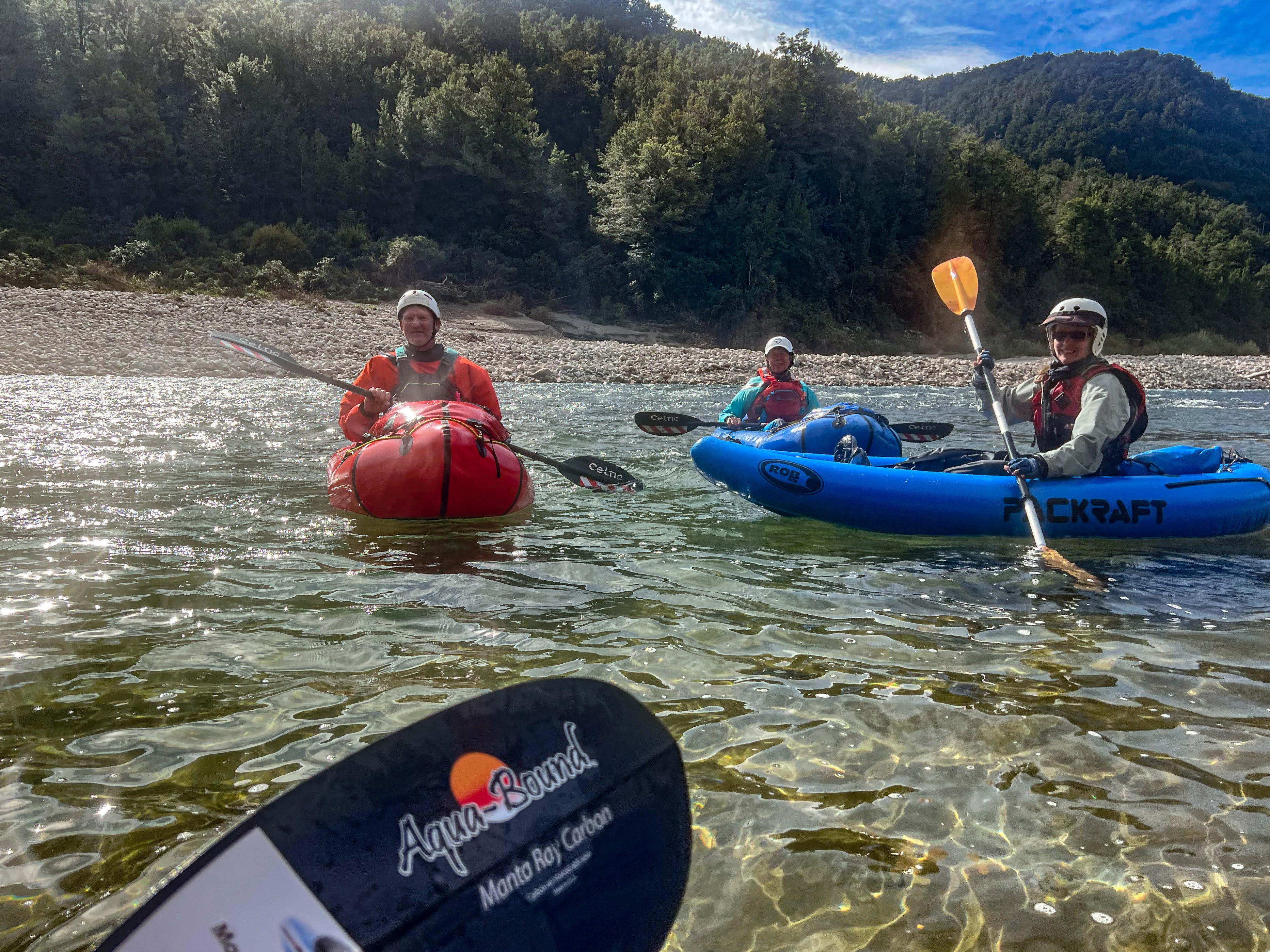
Then in March I joined Brendon Nevin and a group of others for a few days on a mini-meetup at Murchison on the mighty Buller River.
The first day we paddled for many hours on a rather low Buller, putting in just above the Owens river confluence and getting out at the campground in Murchison. I was quite tired after the long paddle, so decided not to paddle that afternoon on the O'Sullivans rapid, a Grade 3 rapid further downstream. The gang ran safety and talked people through, as it required hopping between eddies. I watched, but didn't feel intimidated by looking at the rapid, deciding that I would have given it a go if I hadn't been quite so tired.
The next day we decided to tackle the Maruia River. It's a gorgeous section that starts beside the highway then disappears into the wilderness for many kilometres before reemerging next to the highway for an easy takeout. We just needed to leave a few cars at the takeout and drive the rest up to the put in.
There were a few Grade 3 rapids on the run and when we got to the first one I had a good look at it and decided I wasn't going to run it. Then I watched others run it, and decided that perhaps it wasn't that scary, and that maybe I should give it a go. So I did.
The first part of the rapid required paddling across the rapid from right to left to get into an eddy on the left hand side. There was someone running safety from that rock who then gave us instruction on how to get through the next section. That involved ferry gliding across to some rocks and then breaking out to paddle like crazy across the current towards the right. I did it, and even have the video evidence!
[フレーム]
Once I had cracked my first Grade 3 my confidence level grew. I ran the rest of the rapids, even leading down one of them. I was stoked!
The next day my eyes were sore from paddling without sunglasses so I sat out a paddle along the Matakitaki, but on the fourth day I joined the Wellington crew for a paddle down the upper Wairau. This river had been super pushy when I'd paddled it the first time at the St Arnaud meetup, but this time the water levels were much lower and it was a really enjoyable paddle, with just a little bit of excitement.
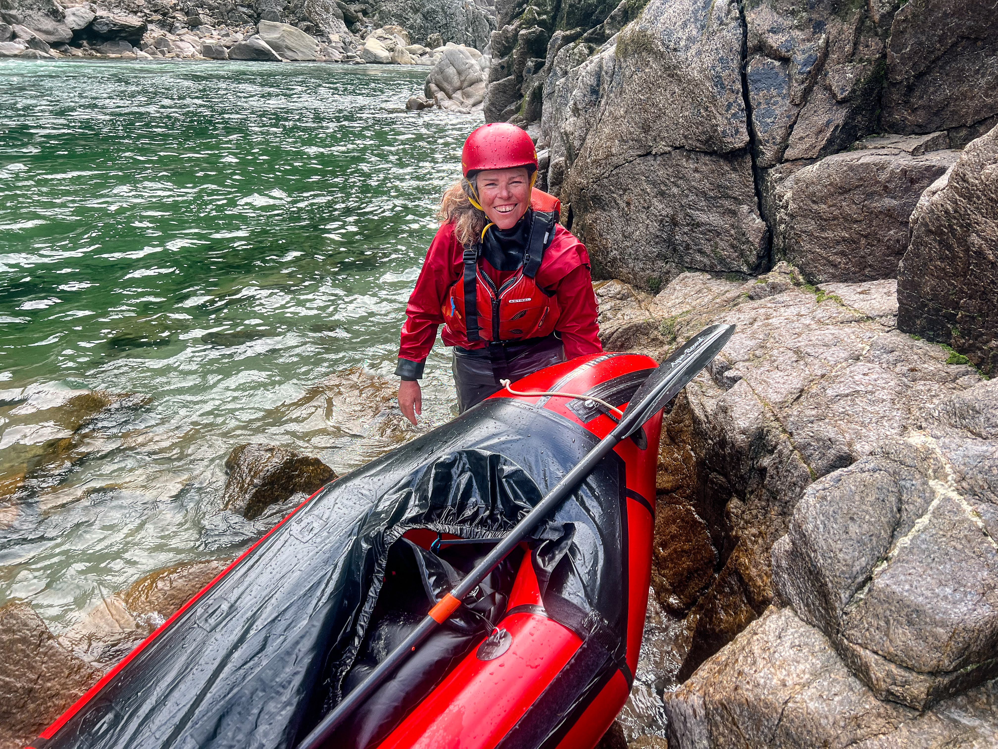
In April, a few of us gathered again at Murchison for some paddling. There were just four of us: Kelvin, Liz, Julie and I. Kelvin and Liz had just finished doing a course with Daan at the NZ Kayak School, and Daan had recommended paddling the earthquake rapids as the water levels in the Buller were real low. This made the rapids Grade 3 rather than 4-5s, so I decided to give it a go.
We had a great day. Kelvin and Liz are so experienced, and very safety conscious, so we scouted the rapids well before running them. Gunslinger was perhaps the most gnarly of them, but my ability to get into the eddy I'm aiming for is pretty good now.
Lower down there's a wave near the Lyell confluence. I didn't try to ride it, but the others did, with varied success. Julie tipped out and lost her boat, and Liz couldn't get to it in time before it disappeared down the next drop. I was on a rock filming, so no help from me. Liz and Kelvin headed off to catch the boat and Julie walked along the river edge. Meanwhile, I capsized on the next drop and had to self rescue since no-one was around to help me. It was a big pool below the drop so an easy self rescue by swimming to the side and into shallow water holding onto all my gear so I didn't lose anything.
Kelvin came back and ferry glided Julie across to the other side of the river where she could walk easily to where her boat was, rescued by some kayakers who had been playing further down the rapids. I ran the last rapid without drama and then it was an easy paddle down to the take out.
The next day Liz, Julie and I paddled the Matakitaki middle section. We'd run that before at the St Arnaud meetup, (the others had also paddled it in March) and although low, it was still navigable and a gentler experience than our more exciting previous day.
The following day was raining, so the rivers started to rise. It was also my birthday, so Liz and I had a leisurely brunch at the local cafe then browsed the shops before scoping out the Mangles for an afternoon paddle. In the end apathy got the better of us and we didn't bother getting wet.
I now feel like a competent paddler. I know I have the skills to decide whether I will tackle a Grade 3 rapid or not, and also the confidence to happily say no and portage if I'm not up to it. Of course it's all very well saying you can paddle Grade 3, you still need to have fellow paddlers with you to ensure safety. So don't expect to see me doing any radical tramps with gnarly paddling sections any time soon...
But the lesson is: Never say never!
Thursday, April 14, 2022
Across the spine : Richmond Ranges Alpine Route
Day 1 Road end to Red Hills Hut 2 hours
Red Hills Hut to Porters Creek Hut 10.5km, 5.5 hours
The track was quite boggy at first as it descended towards the Maitland River, then sidled along high above the river for some time before a pretty dodgy descent to the river bed. Once across the tributary it was a steep climb again to maintain the sidle above the river, with numerous smaller creeks to cross. I stopped at one of the side creeks for lunch, taking off my boots to give my feet some air.
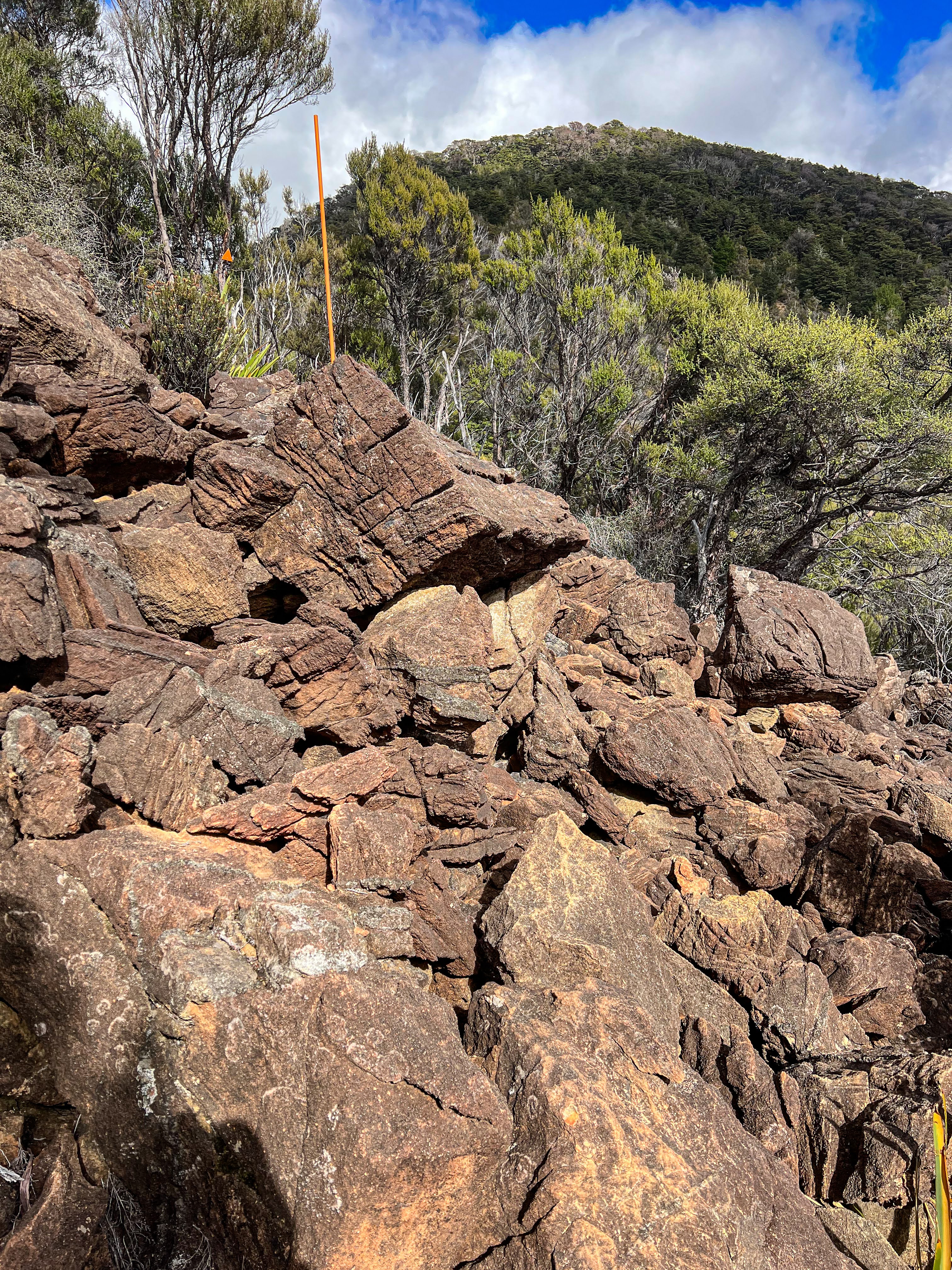
I've been wearing Injinji mid socks and using hikers wool to prevent blisters but there wasn't quite enough padding on my left heel and although I could feel a blister developing I didn't stop to attend to it, just soldiered on. The track climbed away from the Maitland and up a long ridge. The ground all day had been very rocky, and the vegetation dry, mostly Manuka and low shrubs, so not much respite from the sun.
The sun didn't last long and soon the hut was in shade. It had been a tough day, and many other walkers in the hut book also attested to the walk being a tough one. The lack of shade and the dry rocky environment is quite wearying.
After a wash and attending to the small blister on my left heel I had dinner and had an early night. However, at 8:30pm I saw torches and a family of five turned up. Mum, dad, two kids and a five month old baby!! They took 7.5 hours from Red Hills and walked the last couple of hours with head torches. Walking up that dry riverbed must have been pretty tough in the dark, and they wouldn't have been aware of the huge drop not far off the track. Yet the kids were great, not grumpy at all. They were doing TA NoBo and planned to just go to Hunters Hut tomorrow, having planned to take 12 days to do the entire crossing out to Pelorus Bridge. After a wee chat they cooked their dinner and went to bed. I pulled out my earplugs so I wouldn't be disturbed by the baby.
Day 2 Porters Creek Hut to Hunters Hut 7km, 3.5 hours
Hunters Hut to Top Wairoa Hut 10.5km, 6 hours
From the river below the hut the track began to climb, sidling along above the river which had gorgeous pools perfect for swimming in. The wind picked up, not much of an issue at first but once the real climb began it was quite strong. As I got higher I could see down to Tasman Bay. There was also cell coverage so I checked the weather forecast. Still good.
It was a long climb. The wind was blustery and at times strong enough to knock me sideways, so I was using both poles for support. It climbed up to just below Mt Ellis, then there was a very long sidle below the rocky outcrop to join another ridge line. I could see Hunters Hut the whole time!!
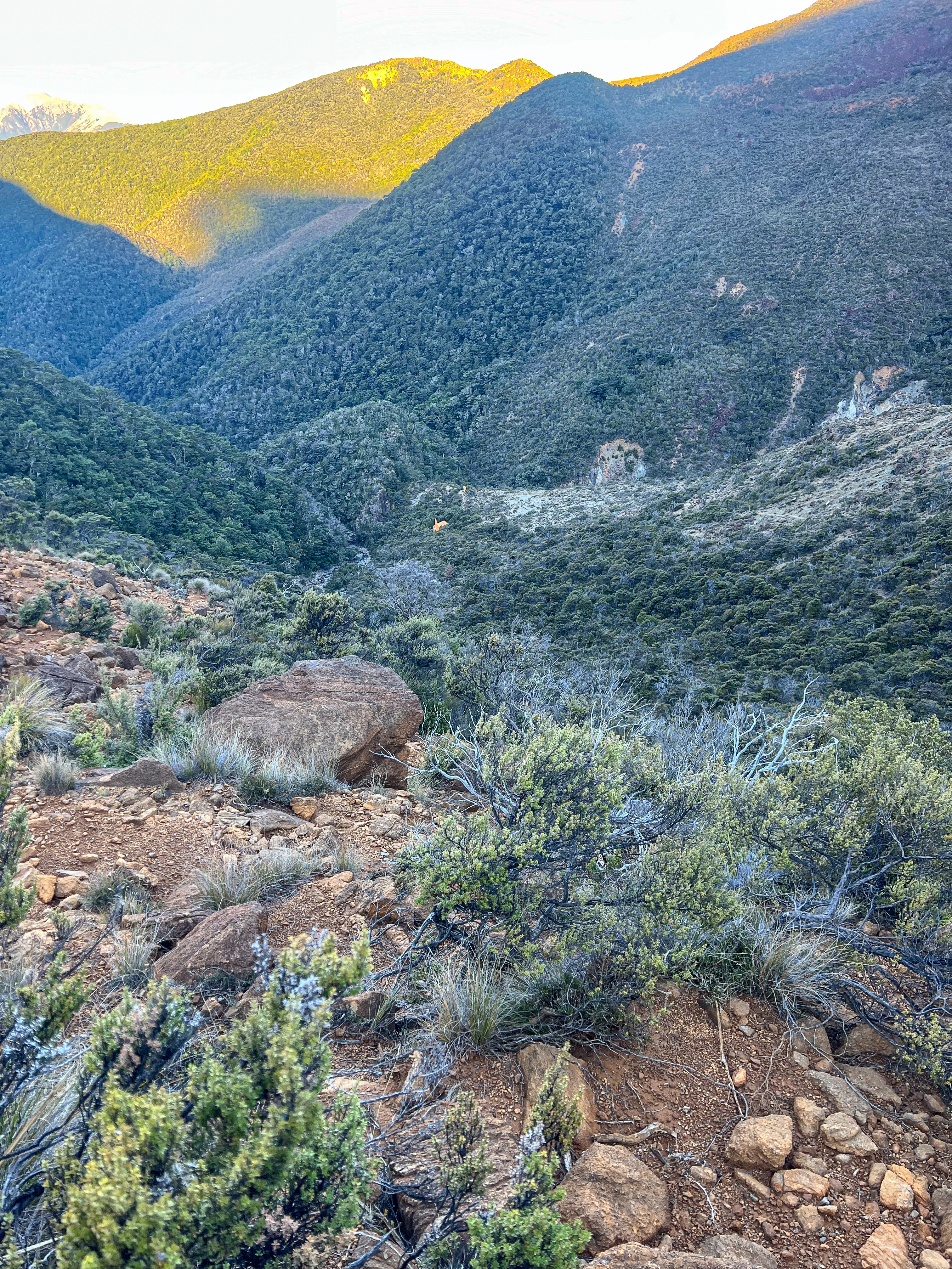
The route followed the ridge down and then headed straight downhill into Wairoa Valley. It was a very long and brutal descent, through tussock, bogs and huge red boulder fields. At times I thought my legs would give out and I had a few falls and scrapes, but nothing serious. At last the bright yellow hut came into view, although the toilet could be seen from even further up, but it still took forever to get to.
It was an old, but cosy hut, and no-one else turned up. I was glad the family had chosen to just walk to Hunters Hut, that wind would have been pretty brutal on the kids, and no way would you want to negotiate those boulder fields in the dark. I was exhausted, so it was another early dinner and straight to bed.
Day 3 Top Wairoa Hut to Mid Wairoa Hut 7km, 5 hours
My hydration plan for the morning was to drink a cup of water every time I crossed a stream or river. Subsequently I drank lots and had to stop to pee lots!! There was some easy walking in the forest but a lot of narrow sidling well above the river and a few ledges to climb up and around. Pretty hard to make good time and at times quite terrifying.
There were spectacular waterfalls and pools for swimming in, but the track was rarely at river level except where there was a crossing to the other side. I thought I was making okay time and then encountered a big tree fall. First I tried to climb through it as I couldn't see a track around it. That ended hilariously when I slipped and went for a fairly spectacular upside down number with one leg still dangling around a branch a la monkey bar. Only I'm not as flexible as I was when I was a kid!! I managed to extricate myself and then backed out and tried a different route a bit lower down and found evidence others had gone that way too.
Once back on the track it was another 30-40 minutes to Mid Wairoa Hut, sitting in a lovely sunny clearing.
Day 4 Mid Wairoa Hut to Tarn Hut 6.5km, 3:45 hours
Tarn Hut to Rintoul Hut 8km, 4:40 hours
The ridge line had lots of rocky outcrops with stunted beech trees and a lot of wasps. These European immigrants outcompete with native bees for the honeydew produced during late summer by a native scale insect that lives on beech trees, and can give you a very nasty sting. There were no bait stations up on the ridge and the wasps were plentiful, but only in the sunny spots, not in the forest below the ridge. Needless to say I didn't linger long anywhere I could see or hear the wasps, but I did take advantage of cell coverage to get an updated weather forecast. It was looking like cloudy conditions in two days, so I planned to get most of the alpine section done by then.
I plunged off the ridge to take the track down to Tarn Hut, another pearler sitting in a grassy clearing. The nearby tarn was looking a little sad, not particularly inviting for a swim. I had a little lunch, filled up my water bladder and returned to the ridge along a different track.
I stopped on the saddle to enjoy the second half of my lunch then headed down. It was an easy scree sidling slope across to the next ridge line then a steep downhill, mostly in forest. My legs were feeling great though the final bit to the hut was a bit of a slog uphill.
Even though I'd tramped for over 8 hours, it was by far the easiest tramping day so far: nothing technical and good track through the forest. The Red Hills section had been much tougher, but tomorrow I would be crossing Mt Rintoul, the crux of the trip!
Day 5 Rintoul Hut to Old Man Hut 4.5km, 4:15 hours
Old Man Hut to Slaty Hut 10km, 4 hours
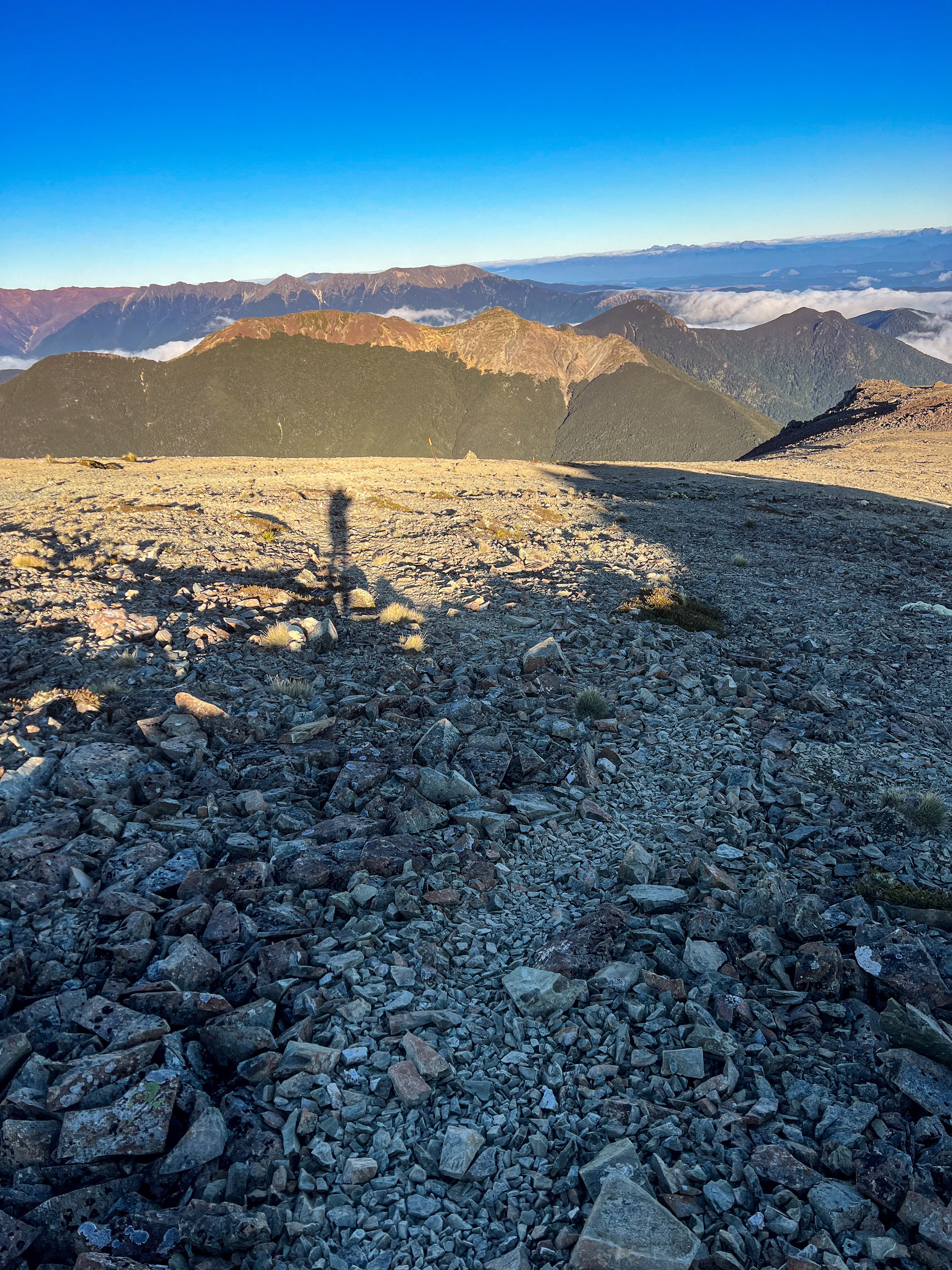
The main Rintoul plateau was broad and fairly featureless, and you wouldn't want to be up there in whiteout conditions as the poles were rather widely spaced. It climbed steadily up to Mt Rintoul itself, and then the hardest part of the crossing revealed itself.
To get to Little Mt Rintoul you needed to climb down through rocks, which was easy, but then there was a steep slippery scree descent, a long sidle across a number of boulder fields, and finally a climb up on a mixture of rock and loose scree to at last make Little Rintoul. It was by far the slipperiest section, but it wasn't particularly exposed, so a fall would scrape skin rather than cause a major injury. Unless you were stupid enough to run it!!
I met a couple of women with their dog just as I got to Little Rintoul, who were a little concerned whether their dog would make it. I reassured them the route wasn't as gnarly as I had been expecting: there were rock scrambles on the Wairoa river section I'd found harder. It took about 3 hours over the tops and then another hour down the steep descent to the ridge line to Old Man.
The detour to Old Man Hut involved a loss of 200m vertical, and a climb back up to the ridge again. Since I was making good time and hadn't found the Rintoul crossing too difficult, I knew I wouldn't bypass it, simply because I couldn't NOT bag it! So down I went on a steep track through the forest to another sunny clearing. I had enough water so I just had a big cupful to drink whilst there and took my shoes and socks off for 15 minutes whilst checking out the hut, signing the book and having a snack. Then back on with the boots and back up to the ridge. All up the detour took me over an hour: 15 minutes down, 30 minutes up and about 30 minutes chilling, but I had heaps of time, leaving the hut at 11:45am for Slaty.
When I had been up on Rintoul the wind had started to kick in but I was sheltered coming down from Little Rintoul. However once back on the main ridge the wind was quite strong but not as gusty as it had been on the crossing from Hunters. As I left the trees heading towards Old Man Peak it became quite exposed so I put my jacket on. I'd kept my gloves on all day.
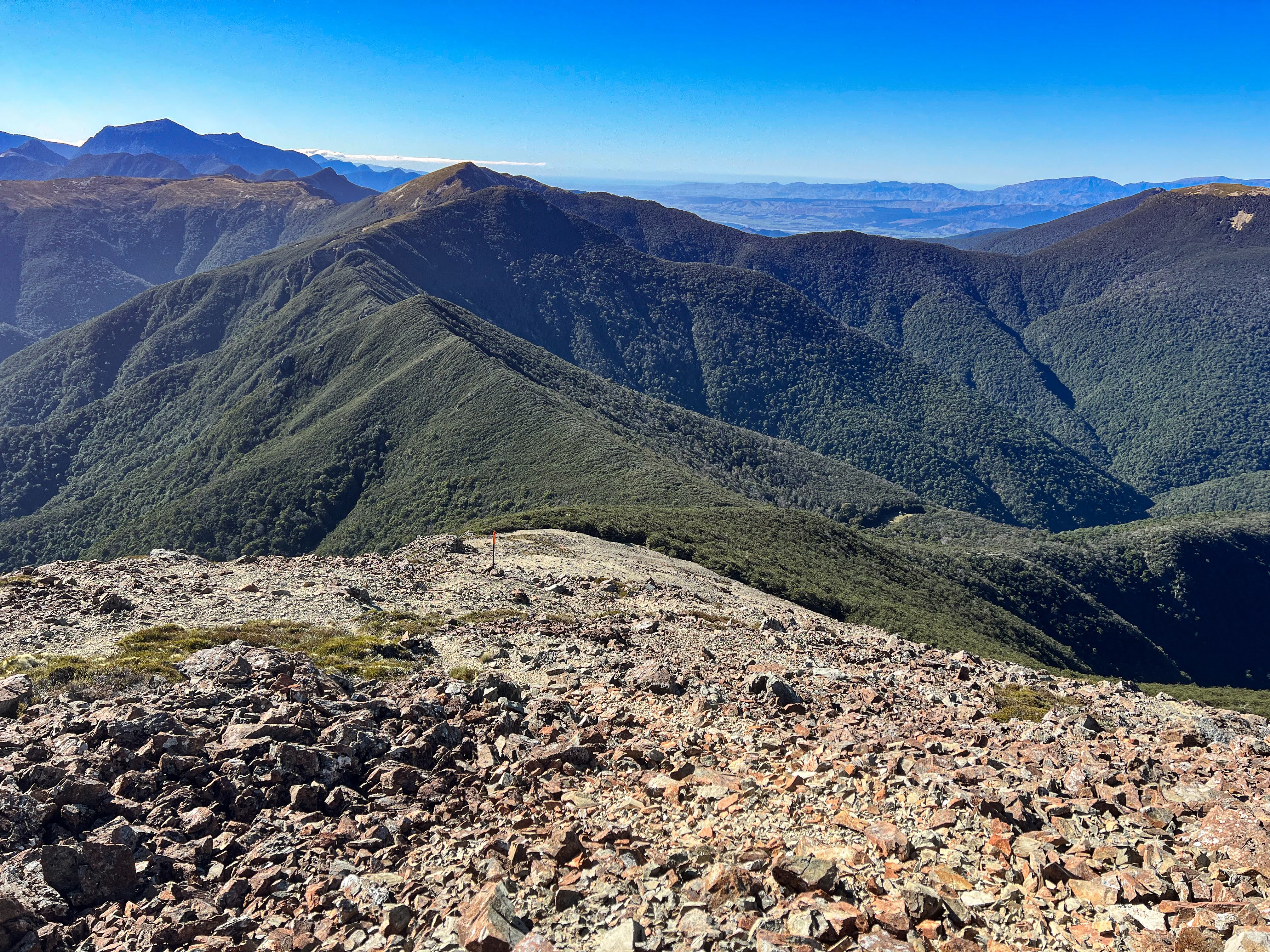
Once I had climbed to Old Man Peak the trail turned west to follow the ridge to Slaty Peak, which meant down some scree and then up again to some wonderful tussock covered meadows. It was the easiest walking of the day and nice to stretch the legs. By now the wind was a headwind, but it was sunny, and with the right clothing I was warm and thoroughly enjoying the expansive views in all directions, including across to Mt Rintoul. The track undulated further until at last Slaty Peak towered above me. The hut was nestled next to the bush line well below the peak with a narrow sidle track across to it. I made it to the hut just before 4pm.
I hadn't been there long when a young Swedish chap turned up. He told me he wanted to make it to Tarn Hut the following day and didn't appear to have done much NZ tramping at all. I suggested that Tarn might be a bit ambitious given the weather may not be great tomorrow and he has to make it over Rintoul first. He took 6 hours from Hackett which isn't much under the DOC times. I suggested he help me collect some firewood, and introduced him to a few tenets of hut etiquette, but he didn't seem very interested, though was happy to enjoy the fire I lit!! I also told him I'd be sleeping in, as I had an easy day, but would wear my earplugs so he wouldn't disturb me when he got up to go.
Day 6 Slaty Hut to Starveal Hut 5km, 2.5 hours
Starveal Hut to Hackett Hut 6km, 2 hours
Hackett Hut to Aniseed Valley Rd 7km, 1.5 hours
As expected it was cloudy on the tops, coming in and out. The Swedish fellow set off a little before me and was immediately swallowed into the mist. I left about 8:30, not concerned about the cloud as I only had to get to Starveall Hut and then I would be descending off the alpine ridge into the forest. There was one more climb up to Mt Starveall before a gentle descent to the hut. By the time I got to the hut the sun was out and I'd left all those clouds behind.
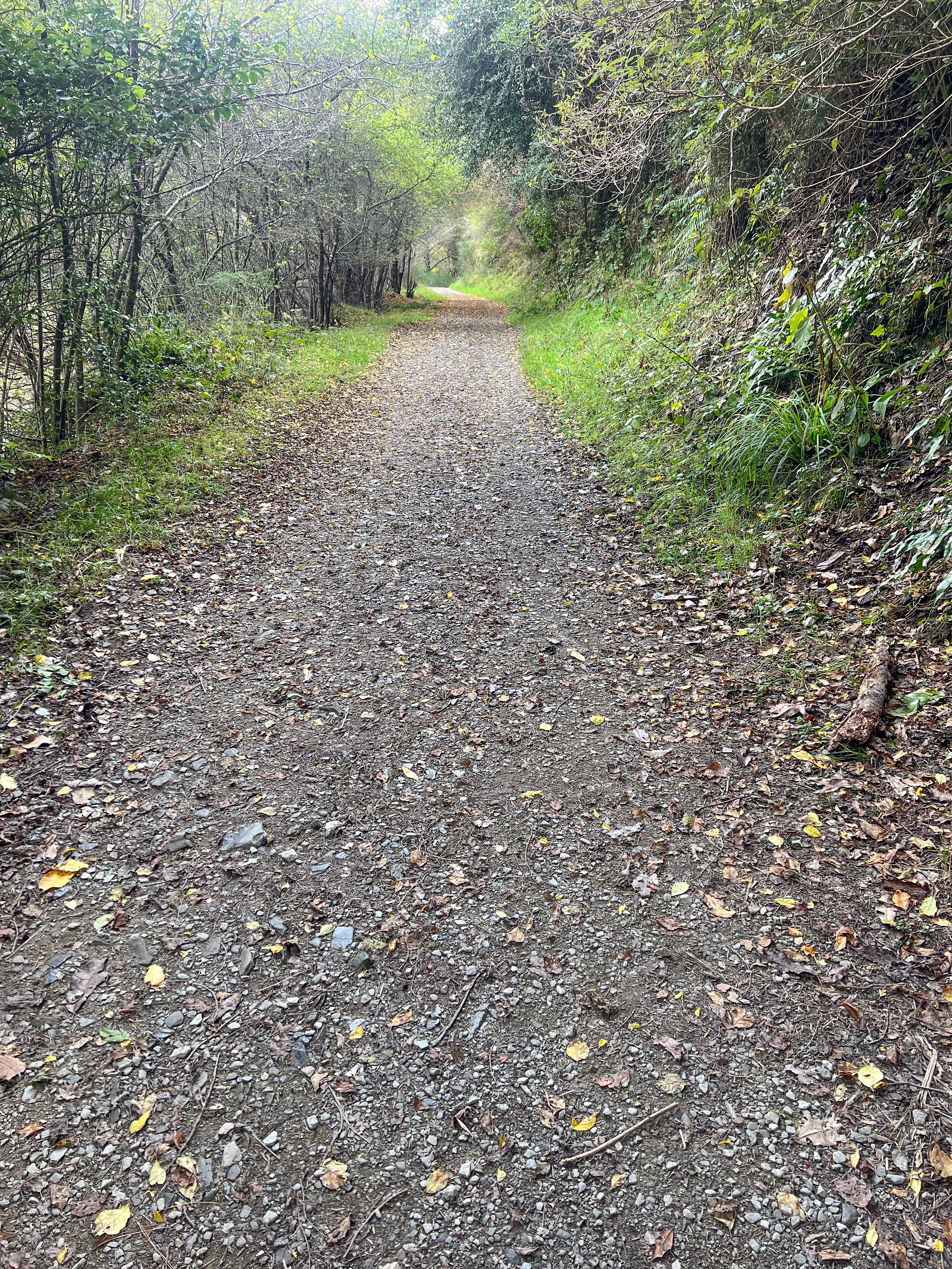
Then it was downhill all the way to Hackett, often on quite a steep track. I crossed the first streams I'd seen since the Wairoa 3 days ago. After lunch at Hackett Hut I then walked out to the roadend. I passed more people day-walking up the Hackett track than I'd met the entire week!
I had messaged Brendon to pick me up at 4. I got there about 3:40 and took off my boots and walked in to the cold river to soothe my feet. Bliss!! The kids and Brendon turned up and after the kids had explored for a while we went back to Wakefield.
After a lovely evening enjoying dinner with Brendon's family and a friend, I headed off the next morning for a few days R and R camping by the beach in Tasman Bay. Brendon's daughter tested positive for Omicron two days later, but luckily I didn't catch it. I had some paddling to do.