Creator of the Tantur "Biblical / Scriptural Gardens"
21 April 2026
Fr. John Paul, S.J, Rector, Tantur Ecumenical Institute
I had a wonderful conversation with Dr. Fleming , who now lives in Florida, regarding his past work in creating a Biblical Garden at Tantur in the 1990s. He has a deep and lasting memory of his time here—the memory of a truly special place.
Rector: Dr. Fleming, the remnants of your work at Tantur–the Biblical Garden and Pond, are still rather visible. What brought you to Tantur and what inspired you to create this "garden"?
Dr. Fleming: In the late 1980s, as a biblical archaeologist, I was invited, with others, to come to "take a look at Tantur" and especially to investigate some mosaics that had been found there. We discovered that there were many mosaic tiles in the area around what became the "biblical garden"—which supported evidence of a Byzantine-era church or pilgrimage center that existed between the present day "Vineyard Tower" (which I built as part of the Biblical Garden) and the Hermitage. That whole area appeared to be a quarry, where the stones were removed to build this byzantine era structure. My colleague, Dr. Hananiah Pinto, decided that we would like to do more around this site and we were welcomed by the administration of Tantur to come to Tantur.
We discovered a fair amount of pottery and a "Turning" wheel —for making pottery— that dated sometime between 2100-1900 BC—thus showing evidence of habitation in this area at that time. We also found evidence of a cluster of "Mediterranean cypress," near the "entry gate"—which would have been near the old house at the bottom of the Tantur hill and on the Tantur property.
R: Where was this pottery shard area?
DF: The pottery wheel area was near the remnants of "water pools". These were actually reservoirs and several other reservoirs existed at the time that we first arrived. They were quite muddy and needed to be cleaned out due to many years of being uncovered and with moss and other "crud" growing in that area. In "biblical days", these pools/cisterns would have been covered over to "preserve" the purity of the water. Whatever happened to the stone coverings is unknown, but left uncovered, with the sun hitting upon those pools, moss and other stuff would have grown and overtaken the practical use of the water—and would have evaporated the water, leaving the dry pools to the "elements of nature."
R: It looks like there is a "theater " in that quarry area. Is that something you created as part of the "garden"?
DF: What presently looks like an "theater" was already there—part of the quarry. I simply cleaned up the area around these pools and quarry and planted many "native" flora and shrubs, including grapevines. I then built the Vineyard Tower to look down upon that pool area. Hopefully the grapevines are still growing on that tower??
R: So those water reservoirs and large cut-outs were there when you arrived?
DF: These water pools below where the Vineyard Tower was built were most likely established around the time of the "quarry" for the Byzantine era church. However, several of these deep water pools had steps going down into them. While others thought that they may have been replicas of "mikvehs"(Jewish ritual baths), I was indefinite about this. I think that as a chapel or pilgrimage site, they were more of a "baptismal" pool since there are steps leading into several of these pools that would have been part of the baptismal ceremony at that time.
There was also a "hoisting" device that was next to a water trough so that it could provide water to other areas around this quarry and church structure. The water came from an intermittent "siphon" spring that flowed there at times. There were several of those springs on the larger Tantur property.
R: Was this quarry area itself the location for this Byzantine era chapel or pilgrimage site?
DF: The small cliff by the pools (and below the Vineyard Tower) would have led up to the Eastern part of the octagonal church built between that cliff and another cliff to the west—quarried out to provide the stone for that structure. There was also evidence of an atrium being in that area of the church as well. The entry would have been near the cliff by the Hermitage (thus allowing everything facing the "east"). The "apse" of this church would have been in that flattened area between where the Vineyard Tower is and the hermitage. This is where mosaics were found as well as further down the hill to the east of the pools, below the "church".
R: How did it happen that this structure would have been built here?
DF: In that Byzantine era, there were actually 6 of these "pilgrimage sites" established. This one located on the Tantur property was #5 of those 6. Near Mar Elias Monastery, nearby to Tantur, was another structure called "Mary’s Rest" (Kathisma)—which was #4. It was most likely a larger structure than that located at Tantur. #3 was in the area of Ramat Rachel, #2 was in the "Arnona area" and #1 was on the hillside next to St. Andrews Scottish Church. #6 (as yet, not located) was somewhere between Tantur and Bethlehem.
This series of pilgrimage sites would have followed the main route ("the Kings’ Road") from Jerusalem to Bethlehem (and continuing to Hebron and beyond). It would have somewhat followed the remnants of the "Herod Aqueduct"—which supplied water to Jerusalem from "Solomon’s Pools" just to the south of Bethlehem. While called "Solomon’s Pools", they were built in Herod’s time. Across the (Hebron) road (to the east) from our Biblical Garden and the Pond areas were the ruins of a Herodian-era Roman "guard house" –adjacent to the "Herod Aqueduct". While I was there, a modern Checkpoint was established in that area. I don’t know if the ruins of that former "guard station" or the aqueduct are still there.
R: What inspired you to put a Biblical Garden into that area?
DF: As an archaeologist, I’m also interested in scripture and letting archaeology help to inform scripture. I have been interested in creating these ‘scriptural’ gardens to help people today understand what life would have been like ‘way back when’, since there is a connection between the land, living on the land, and scripture. Given the pool areas, the quarry area, and the evidence of a Byzantine era faith structure at this site, I wanted to create something that would attract interest and inform their faith experience. That area of Tantur was perfect for ‘recreating’ something.
Once we cleaned up this area, we planted local flora. We then continued to expand the "Garden" beyond that pool area. Wrapping around that hillside to the south, the garden ‘walk’ led to yet another pool area where a square structure was carved out, in imitation of a "tomb" being carved into the rock–to give an idea of "tomb areas" within a garden. Past that second pool area, we continued the path around a short distance leading to an open area. There we created the "Pond/Lake". It was just below what is now the Student Center. The pond included an island in the middle, with shrubs, irises, and a tree, so that the ducks I brought could have a "refuge of safety" from predators like the cats, foxes or jackals. Dr. Hananiah Pinto and I would lead tours through the garden and Dr. Pinto’s family (living quite near Gilo, to the immediate west of Tantur) would frequently play there. I also created a "rock-lined stream" that pumped water up from the Pond to the Student Center and which then flowed back down into the Pond, giving the impression of a spring that would feed the pond. Along the stream and the pond, I also planted many "dark purple—almost black—irises"—are they still there?? In addition, I planted cacti, rosemary, lavender, and other flowering shrubs. The larger area was (and I presume still is) surrounded by many olive trees, thus allowing a reflective, quiet, park-like atmosphere.
R: When you came to Tantur, did you live in the main building, one of the apartments, or in the Hermitage?
DF: At the beginning I lived for a year or two in the building beneath the Chapel. It was an easy walk down the hill to that larger quarry area. I then moved into the "Hermitage" (on the hillside below the Tantur Tower) so I could be closer to our work in the "Biblical Garden". Interestingly, behind the Hermitage, there was a small "house-cave". I kept tools there along with my donkey, my "beast of burden" in helping to move materials in creating the Garden and the Pond. Many children who came with families to visit that Garden area enjoyed the donkey as well–since we provided "donkey rides"!
The grass in the area between the Biblical Garden and the Pond and Student Center was kept low due to a small flock of sheep I had who would eat the grass and help "fertilize" the area with their "droppings". Again, the sheep in this biblical garden would be a reminder of the biblical and scriptural nature of the place and that whole area.
Just above that "pond/lake" area was a building, which I understand is now called the Student Center. While I was there, it was empty and so we established a kitchen and dining room area for visitors and workers. What I most enjoyed about that building was the view from the rooftop, so I built a spiral staircase going to the roof. Is it still there and used??
R: It is, indeed! I’m sure that the people in that time you were here enjoyed the tours and the quiet space–as well as picnicking by the Pond. Other local families have mentioned how much they enjoyed that area.
DF: We still have photos, brochures, and a "walking path" guide of the "Scriptural Garden". We can send them if you wish.
R: Please send!! It is important that we have things like this as part of the history of this Tantur location. Thank you for taking the time to share all of this with me. It is so important to know of your experience, your findings, and your work here at Tantur.
DF: I truly loved being at Tantur, even though I would also be away for 2-3 months teaching or giving lectures abroad (or within Israel) on biblical archaeology. Thank you for letting me share this experience with you.
Various photos follow—of "cisterns", vinetower, Salameh family enjoying picnic at Lake, flat areas in front of Vineyard Tower
]]>On 23 and 24 January 2026, the Greek Orthodox Patriarchate of Jerusalem and the Custody of the Holy Land publicly confirmed the imminent start of works, undertaken with the cooperation of the Armenian Apostolic Orthodox Patriarchate. In their joint communiqué, the Churches say the project will be carried out "under the auspices of the Presidency of the State of Palestine," in accordance with a 2024 presidential decree and "the historical Status Quo governing the Holy Places."
In Bethlehem, that language is not ceremonial. The Status Quo is the legal and liturgical framework that governs shared sanctuaries and blocks unilateral action. In that context, the fact that the custodial Churches are speaking in one voice is itself a concrete ecumenical outcome.
The structure above the Grotto reads like a palimpsest. A first basilica was commissioned in the fourth century under Constantine and Helena and dedicated in 339. After its destruction in 529, the complex was rebuilt under Emperor Justinian in 565, giving the church much of its present form. Later centuries, particularly during the Crusader period, added mosaics and decorative elements. The site ultimately became one of the Holy Places regulated by the Status Quo, a system that still governs rights, spaces, and daily practice.
That continuity matters. This restoration is not a stand-alone technical episode. It is an intervention inside a building that has carried nearly seventeen centuries of worship, repair, and cumulative strain.
The communiqué is measured in tone but specific in scope. It states that the project concerns restoration "in the Grotto of the Nativity" and also includes "technical reinforcement measures in adjacent sections." In other words, the works are not confined to the devotional focal point alone. They extend to the surrounding structural and circulation zones that support the sanctuary as a whole.
The statement also stresses governance and continuity. The project is anchored in "the historical Status Quo governing the Holy Places" and will proceed "under the auspices of the Presidency of the State of Palestine." For execution, the Churches point to the Italian firm Piacenti, chosen to ensure "continuity of method, craftsmanship, and artistic sensitivity." Preparations, they add, are complete and the works are now "on the threshold of commencement."
Before visitors see equipment or any obvious intervention, the first visible change is subtraction. Terresainte.net reports that textiles and decorative elements are being removed by each community according to its established rights and liturgical practice. The effect is a Grotto that looks less staged and more honest: a worked, fragile interior that will now be treated as such.
On-site reporting points to several practical priorities that the communiqué itself leaves deliberately spare:
Ceiling and rock structure: centuries of soot from oil lamps have darkened surfaces, compounded by traces of past incidents. Cleaning, documentation, and stability assessment are expected to be central, especially where cracks or stress marks appear.
Marble floor: worn, patched, and interrupted in places, with devotional pressure concentrated around the star marking the place of Jesus’ birth. In a space this tight, repeated gestures over centuries become measurable erosion.
Access staircases: entry and exit routes are not only a crowd-management problem, but also a conservation and safety concern. This aligns with the communiqué’s reference to "technical reinforcement measures in adjacent sections."
Liturgical points and fittings: cleaning and consolidation around key devotional loci where use is constant and space is limited.
Documentation: beyond repair, the project is expected to record the site’s morphology and historical layers, sharpening understanding of earlier configurations and later rearrangements.
The pastoral dilemma is obvious: the Grotto is both a place of prayer and a site of relentless movement. Reporting indicates an effort to maintain access as much as possible by working in phases, isolating successive zones, and using night work when feasible, drawing on practices used during earlier interventions in the upper basilica. Earlier reporting suggested a multi-year timeline; more recent indications point to a shorter process, though no public calendar has been issued.
The communiqué frames the restoration as a shared responsibility: a unified commitment to preserve the Grotto’s spiritual, historical, and cultural patrimony for future generations.
No restoration can add holiness to the place. What it can do is slow the damage that devotion, over time, inevitably inflicts. The aim, as the Churches present it, is straightforward: to ensure that the faithful of all traditions can continue to venerate the birthplace of Christ with reverence, within the Status Quo and through a method trusted by all three communities.
]]>For this year, 2026, the prayers and reflections for the Week of Prayer for Christian Unity have been prepared by the faithful of the Armenian Apostolic Church, along with their brothers and sisters of the Armenian Catholic, and Evangelical Churches. (Jointly published by the Dicastery for Promoting Christian Unity Faith and Order Commission of the World Council of Churches).
As the Apostle Paul asserts in his letter to the Ephesians, "there is one body and one Spirit, just as you were called to the o ne hope of your calling" (4:4). This Bible verse, chosen for this year, encapsulates the theological depth of Christian unity. The concept of "one body" also reflects the nature of the Church. Christianity transcends cultural and national boundaries, uniting believers worldwide in faith and hope.
Let us embrace this divine calling to unity, not as an abstract deal but as a vital expression of our faith. In a world where the Body of Christ is wounded by divisions within and between traditions and confessions, the Apostle’s call to unity is addressed to each of us, not only as separated church communities, but also as individuals within our communities. By living in unity, we not only witness to the love and power of our Lord Jesus Christ but also embody the essence of His teachings. As we support one another and celebrate our diverse gifts and talents, let us reflect the heart of Christ and further His work on earth.
At the Institut du Monde Arabe (IMA) in Paris, the exhibition Saved Treasures of Gaza: 5000 Years of History turns archaeology into front-page news. It presents ancient objects, but its story is sharply current: a small strip of land, under bombardment, fighting to keep its memory alive.
Running from 3 April to 7 December 2025, the show gathers around 130 artefacts that track Gaza’s history from the Bronze Age to the Ottoman period. Most works come from the Musée d’Art et d’Histoire in Geneva, in partnership with the Palestinian Ministry of Tourism and Antiquities and the IMA.
Gaza sits on one of the region’s classic fault lines. It links Africa and Asia, the desert and the Mediterranean Sea. Caravans once arrived from Egypt and the Arabian Peninsula. Ships sailed from its port toward Cyprus, Greece and beyond. Canaanites, Egyptians, Philistines, Greeks, Romans, Byzantines, Muslim dynasties and the Ottomans all passed through or ruled here.
That succession of powers is visible in the gallery. Excavations since the 1990s at sites such as Tell es Sakan, Tell el Ajjul, Anthedon and the Byzantine church at Jabalia revealed a dense field of towns, ports and religious sites. Finds from those digs form the backbone of the exhibition and show Gaza as a full player in regional trade and culture, not a footnote.
The title is literal. These works survived because they left Gaza years ago.
In the late 1990s, Palestinian and French archaeologists built an exhibition called Mediterranean Gaza. It brought 221 artefacts to the IMA and other venues in France. While the show was travelling, the Second Intifada broke out. Returning fragile objects to a besieged and unstable Gaza became too risky. The collection stayed in France, then moved to Geneva for safekeeping.
Many of the pieces come from the collection of Jawdat Khoudary, a businessman from Gaza who bought or rescued artefacts from building sites and informal digs. He donated his collection to the Palestinian Authority in 2018. Objects that remained inside the Strip are now damaged, missing or presumed destroyed.
Those that were already abroad escaped that fate. Geneva highlighted them in 2024 in a show on threatened heritage. From that starting point, the IMA and its partners developed Saved Treasures of Gaza.
Curator Elodie Bouffard, curator and the Head of Exhibitions at the IMA, working with Palestinian architects Elias and Youssef Anastas, from AAU Anastas, structures the exhibition in two movements.
The first section is historical, guiding visitors through Bronze and Iron Age artefacts that highlight Gaza’s early role in regional trade, followed by Hellenistic and Roman coins, figurines and everyday ceramics that reveal its strong Mediterranean connections. It then turns to Byzantine works, including a striking sixth-century mosaic from the Deir el Balah area with intricate geometric and vegetal patterns and hints of Christian imagery, before concluding with Islamic and Ottoman steles and inscriptions that trace Gaza’s story into the early modern period.
Wine amphorae, glass vessels, oil lamps and sculpted heads of deities anchor the narrative in concrete objects. They point to a city that traded, produced and exported goods on a large scale.
The second movement shifts the register. Historic photographs from the École biblique et archéologique française de Jérusalem are paired with recent images from Gaza. Visitors see churches, mosques, historic houses and archaeological sites in their earlier state, then in rubble.
Large wall maps, based on recent research, plot cultural sites by category and level of destruction. The result is blunt: in little more than a year, a significant slice of Gaza’s built heritage has been hit.
Since October 2023, international organisations have recorded extensive damage to religious sites, museums, archaeological zones and old quarters across the Strip. Some of the very locations that produced the objects now shown in Paris, such as the Byzantine church at Jabalia or the Mamluk-era Qasr al Basha, have been heavily damaged.
French and Palestinian researchers responded by compiling an online inventory of bombed heritage using satellite images and archival records. The exhibition incorporates this work. The museum becomes a temporary data room and memory bank for sites that are now inaccessible or destroyed.
The show also speaks to politics and diplomacy. IMA president Jack Lang describes it as an act of public service and a tribute to "young and vibrant" Gaza. French president Emmanuel Macron visited soon after the opening and used the occasion to restate his support for recognition of a Palestinian state.
Beyond official statements, the exhibition works on a different register. It offers clear labels, timelines and maps. It introduces Gaza as a historic port city, not only as a scene of war. It invites visitors to look at names on the map — Deir el Balah, Jabalia, Gaza City — and connect them with mosaics, amphorae and carved stone, not only with breaking news alerts.
Saved Treasures of Gaza achieves three clear aims. It restores Gaza to its place as a centre of cultural production, with objects that testify to a city that once exported wine, laid refined mosaics and minted its own coins. It also documents the scale of cultural loss, using photo pairings and maps to show which churches, mosques, museums and historic homes have already been destroyed or severely damaged. And it offers a setting for informed solidarity: rather than scrolling past anonymous images of ruins, visitors encounter context, timelines and names, supported by a catalogue and essays on archaeology in Palestine, the history of the collection and the ethical questions raised by safeguarding displaced heritage in Europe.
The show does not rebuild homes or stop airstrikes. Its work is different. It holds part of Gaza’s past in public view at a moment when that past is at risk of vanishing from the ground.
In the galleries of the IMA, Gaza appears not only as rubble and crisis, but as a place where people have lived, traded, worshipped and created for five thousand years. That is the core message of Saved Treasures of Gaza: the Strip is not only a battlefield. It is also an ancient city of the Mediterranean, and its story is not easily erased.
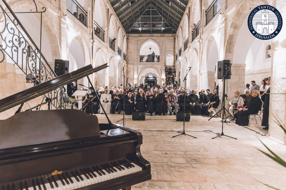
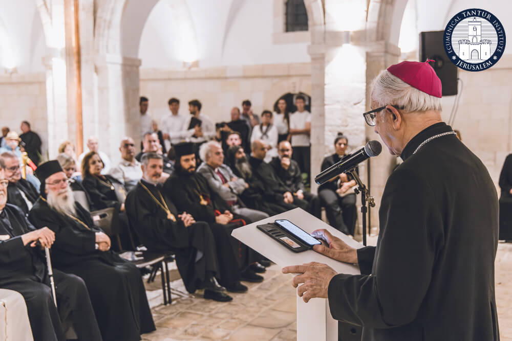
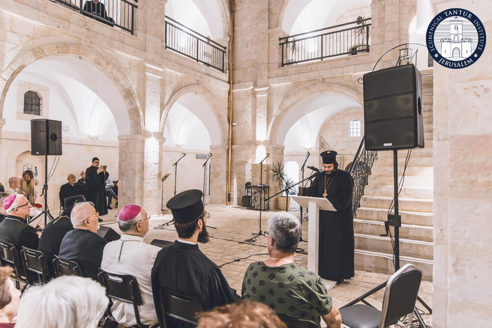
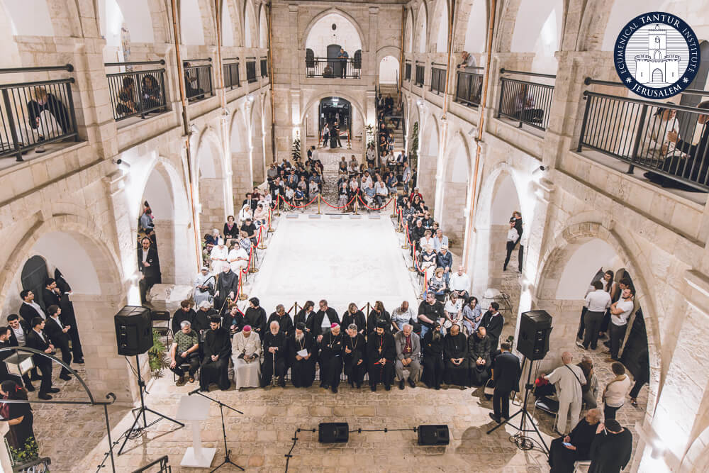
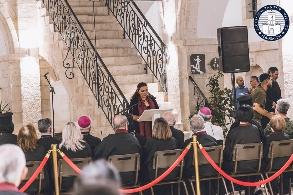
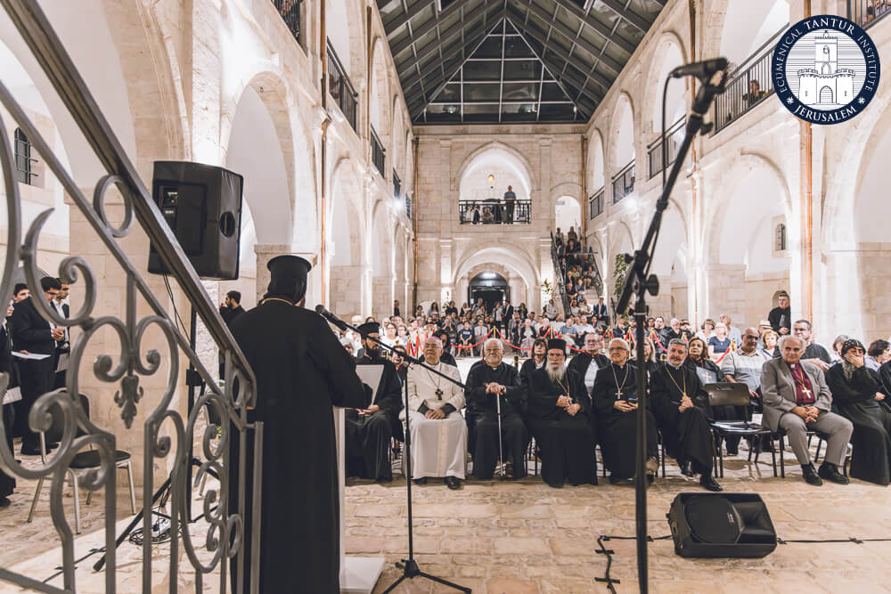
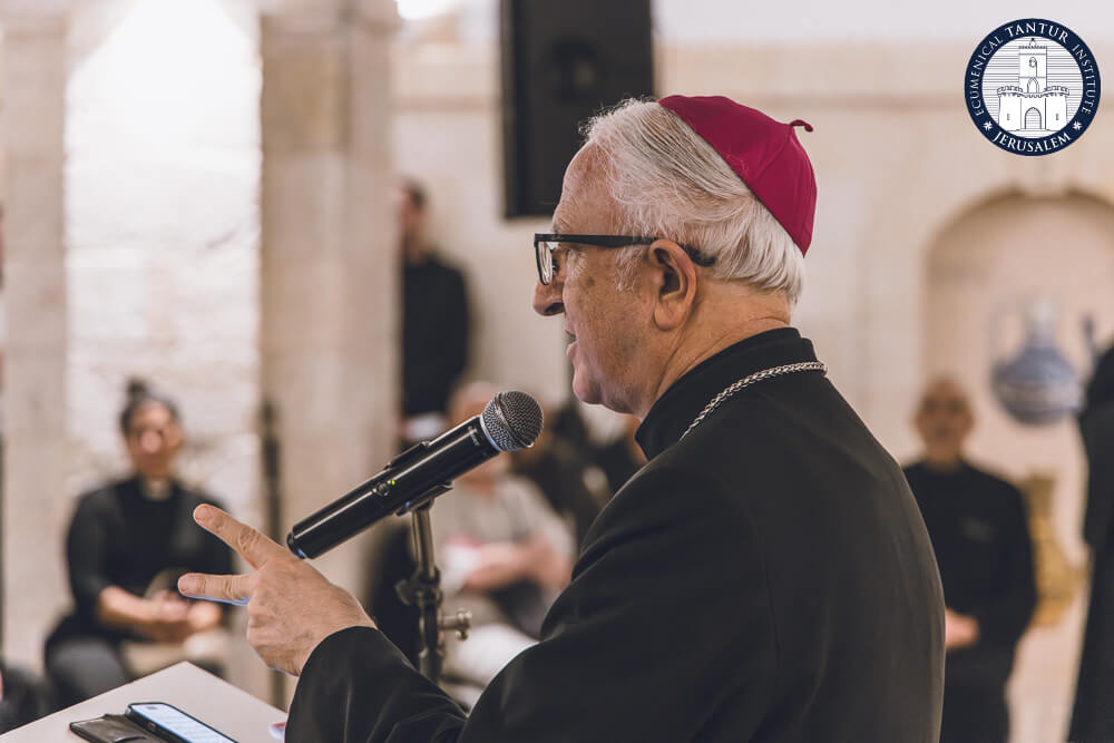
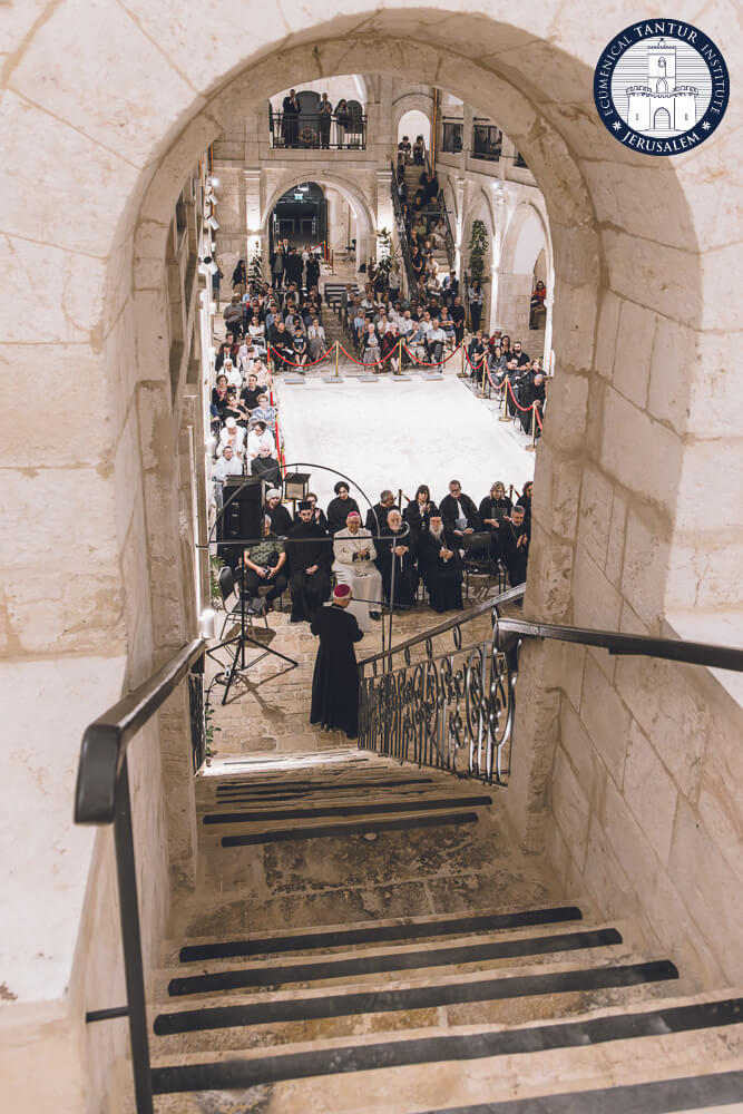
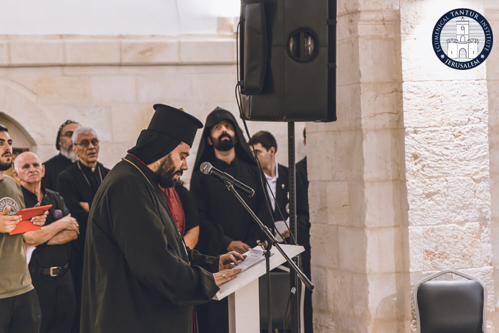
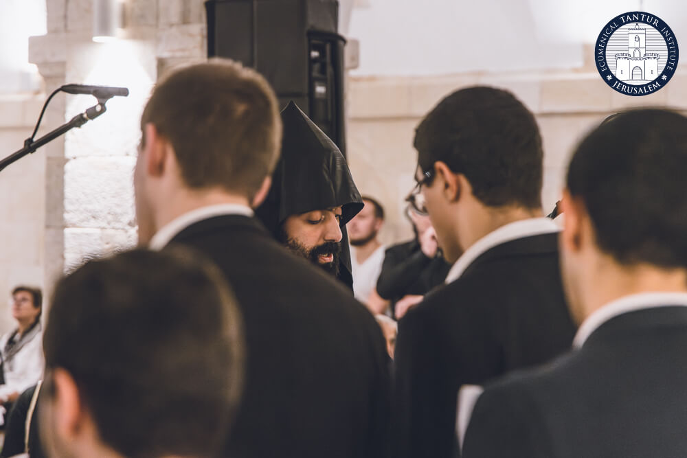
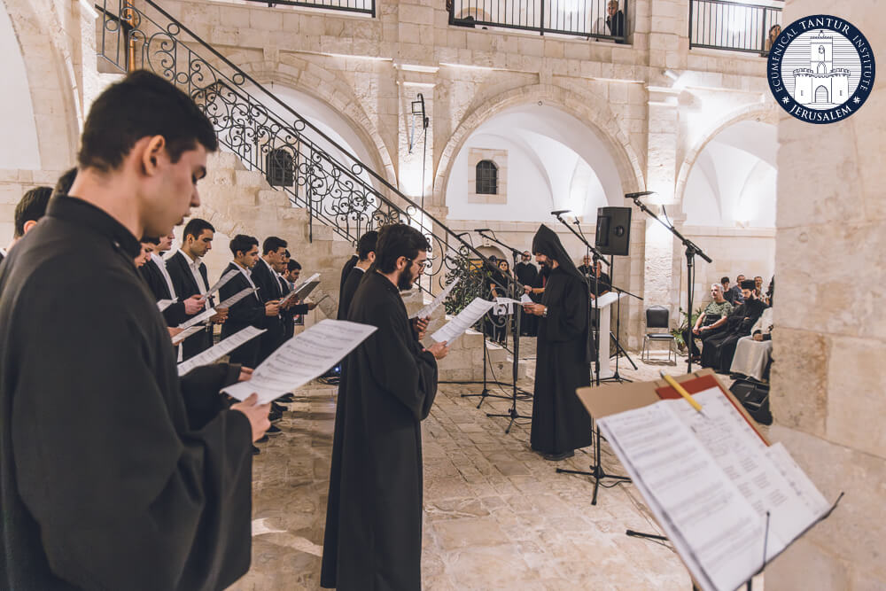
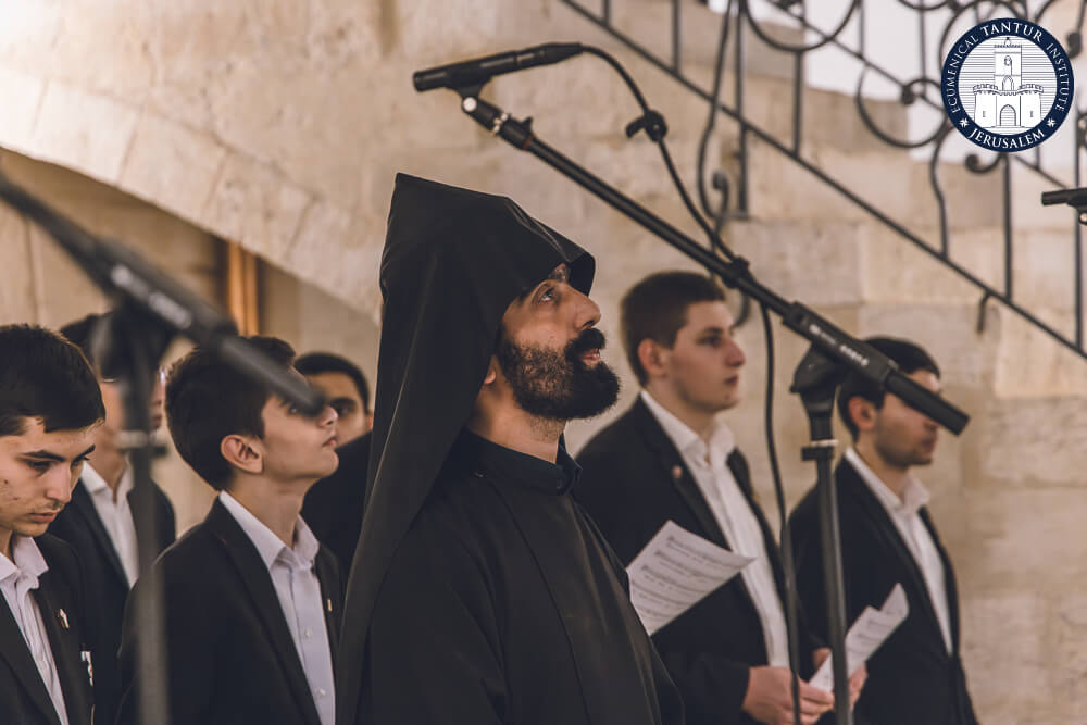
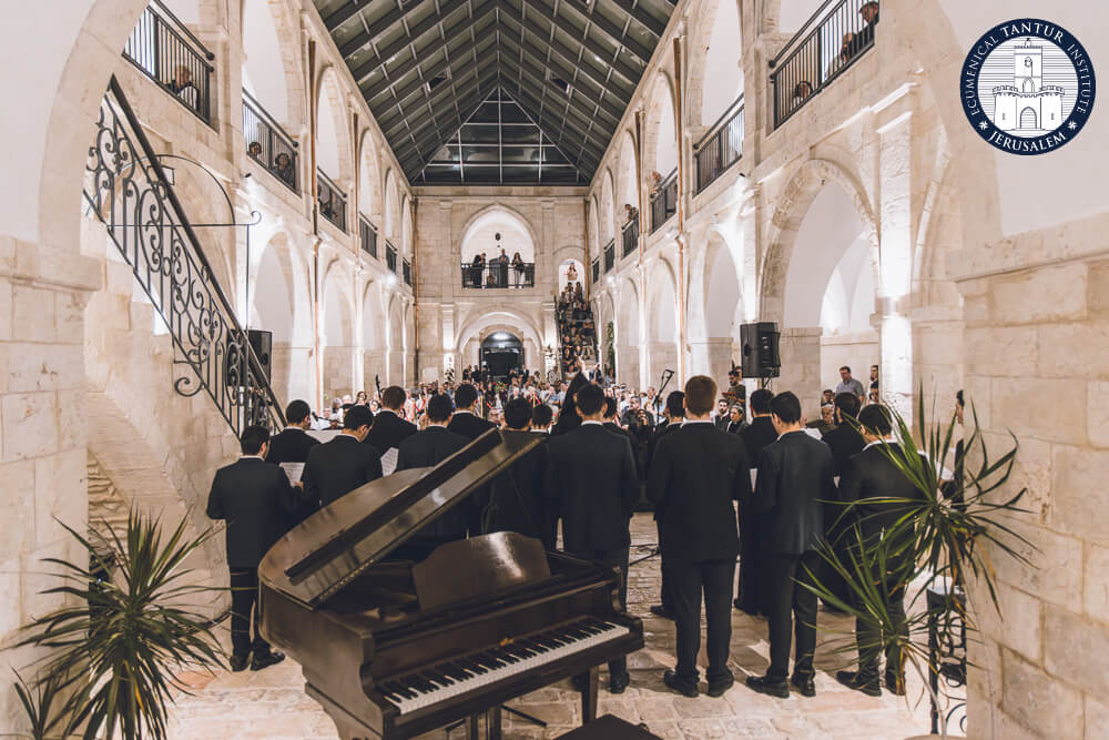
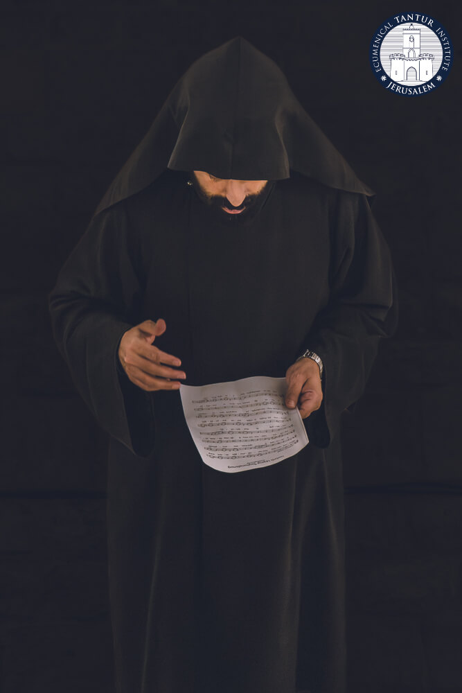
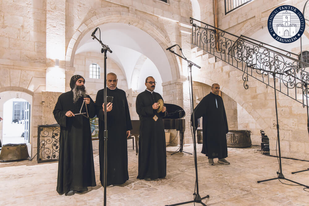
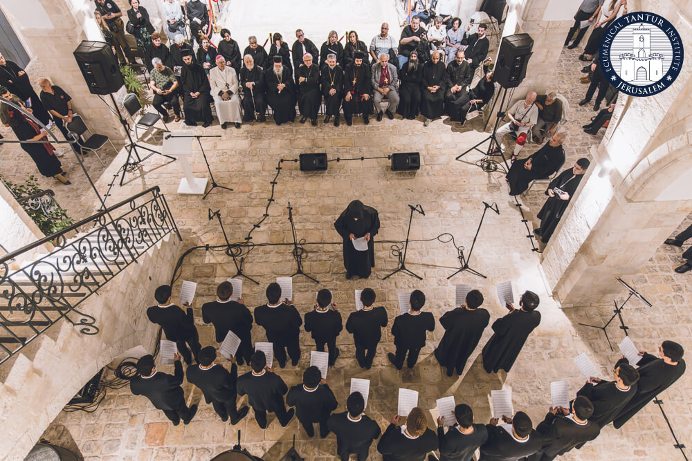
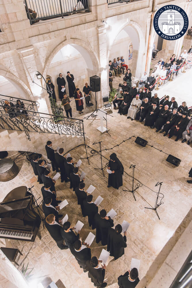
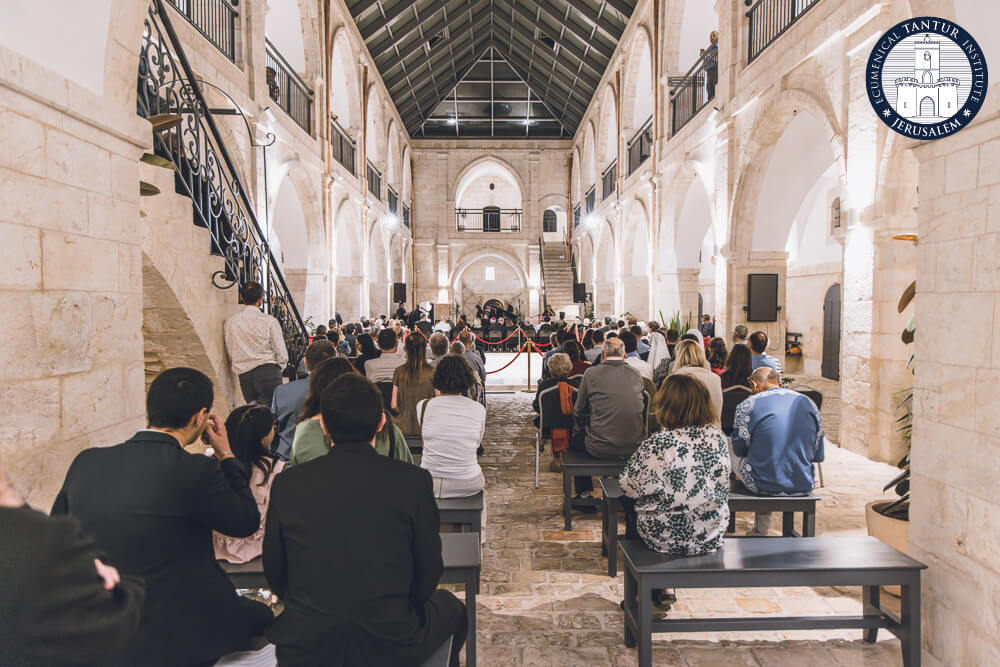
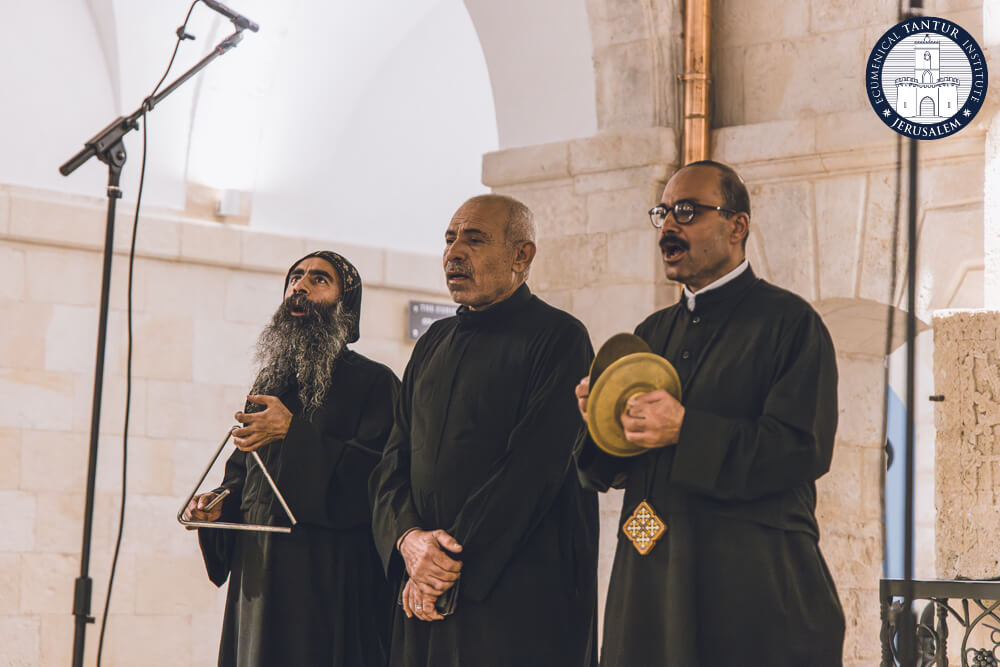
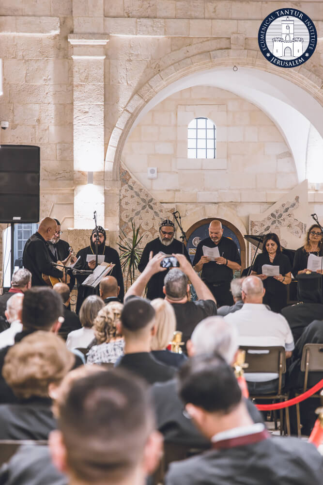
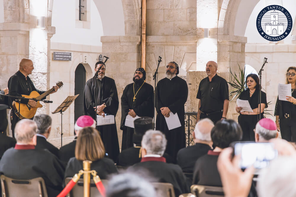
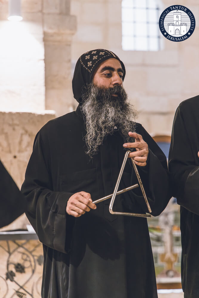
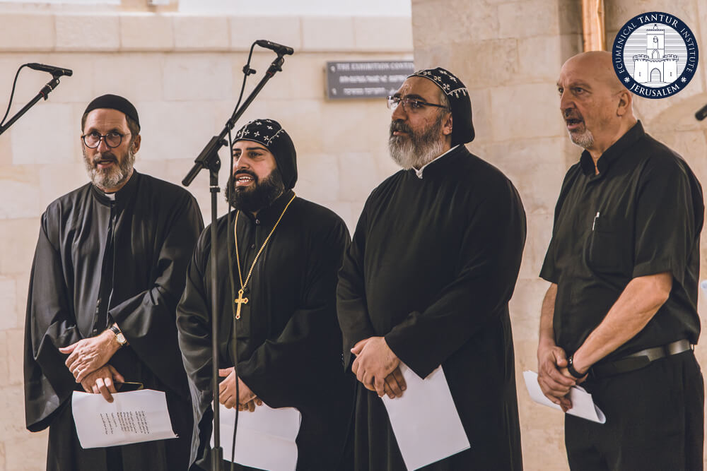
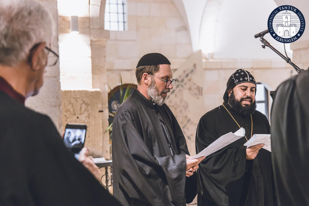
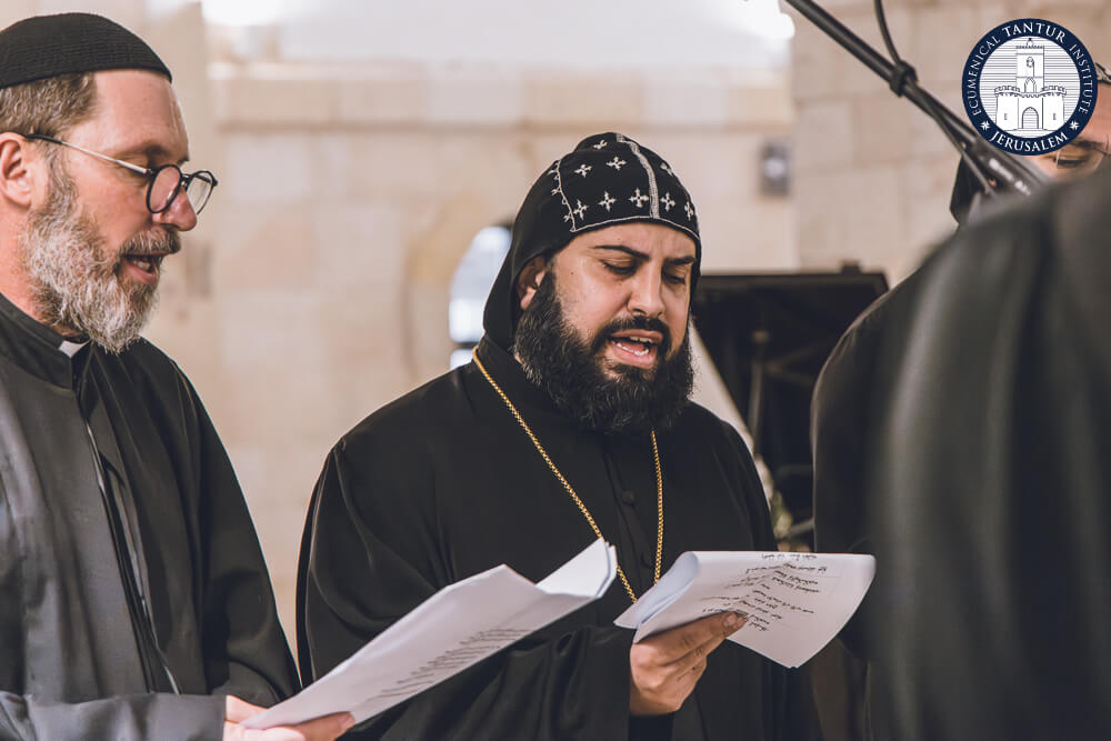
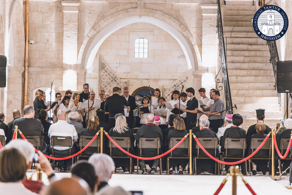
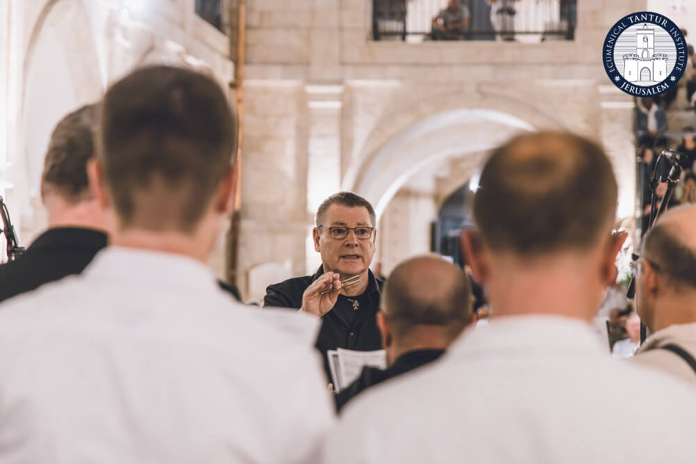
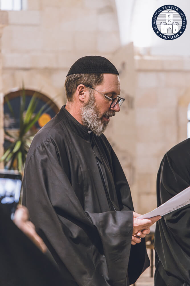
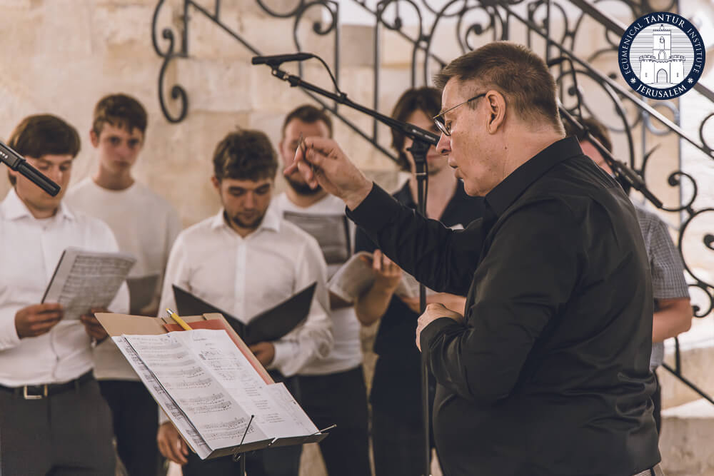
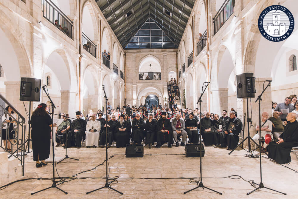
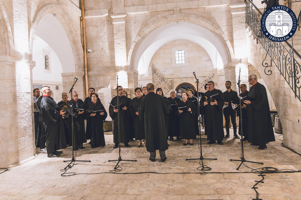
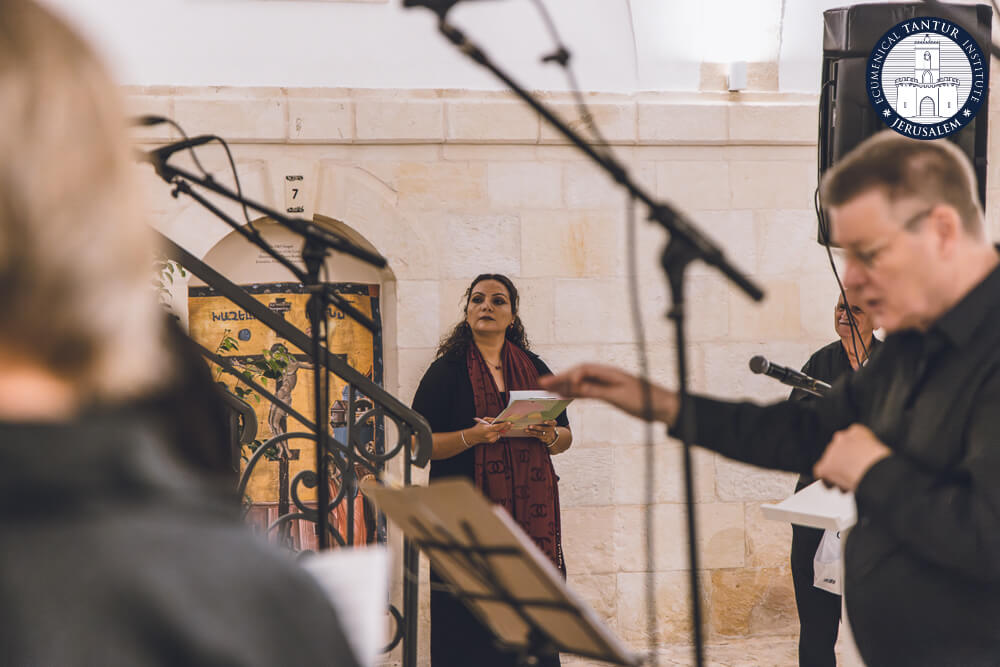
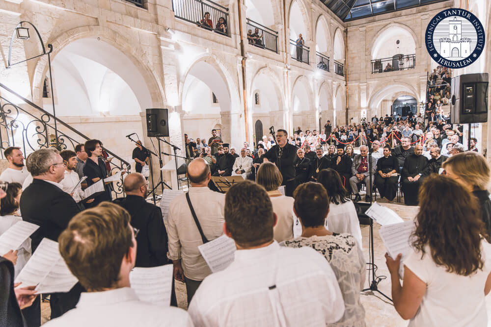
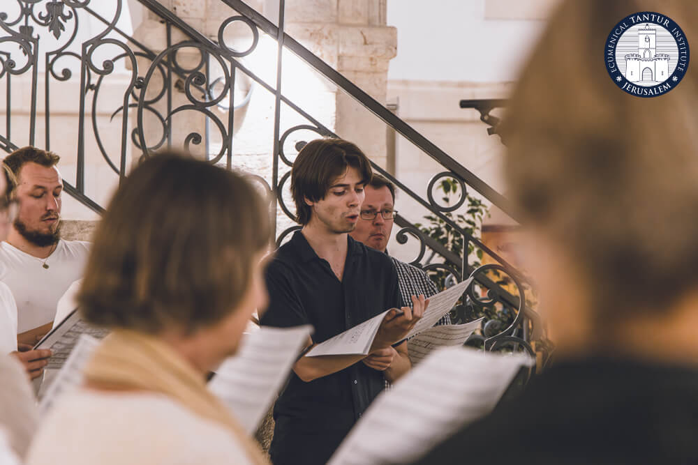
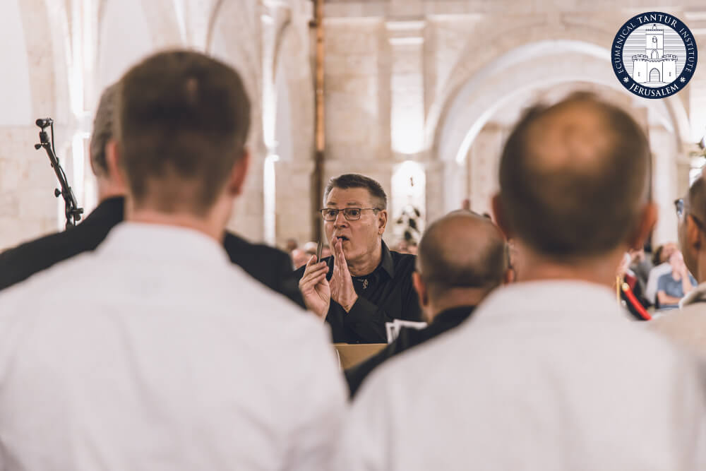
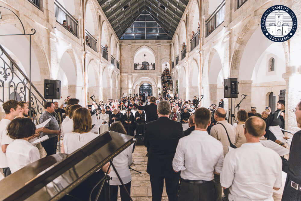
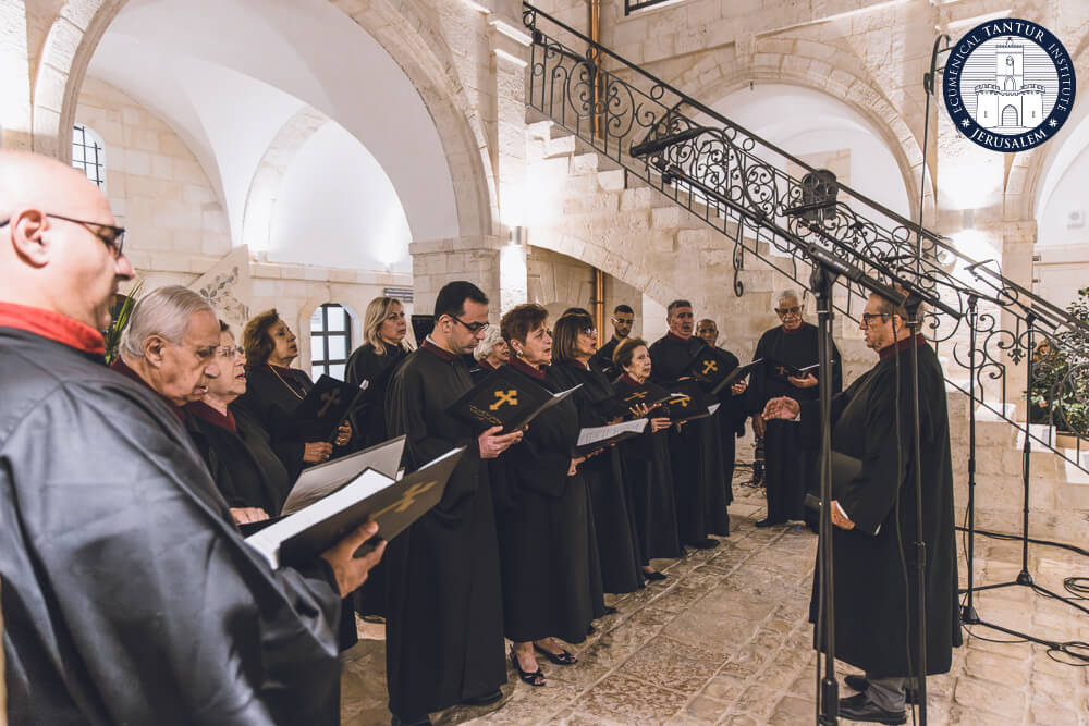
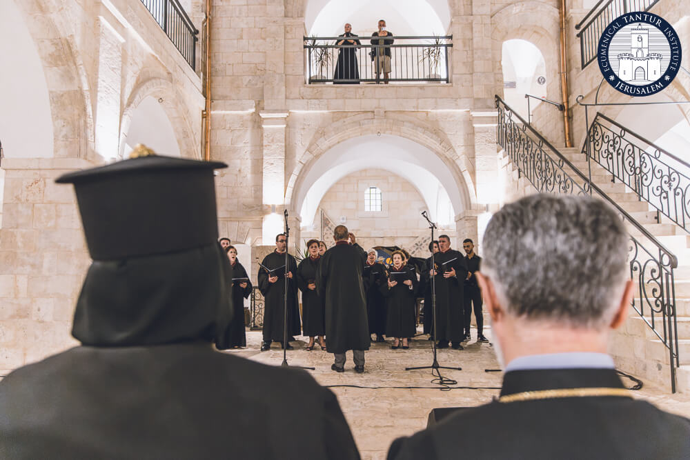
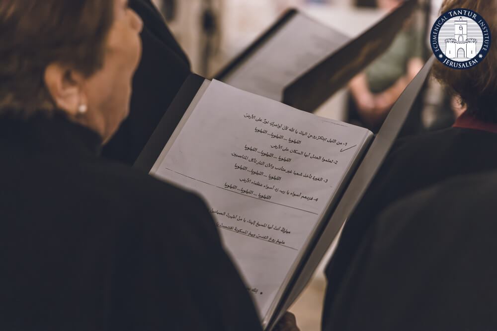
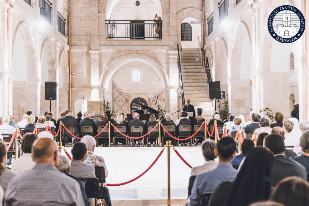
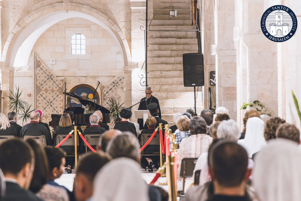
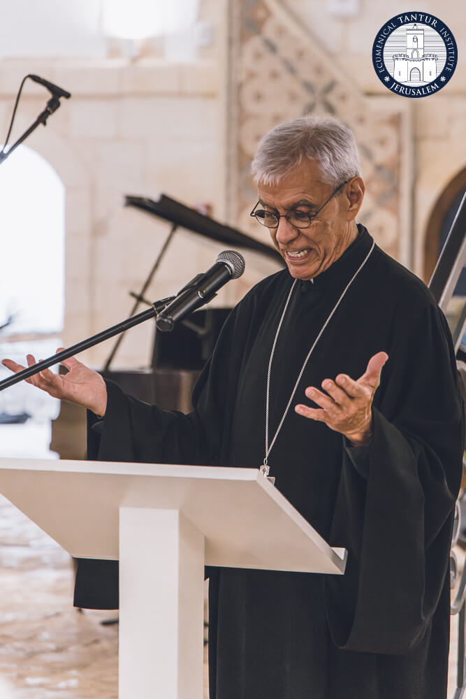
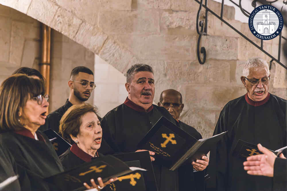
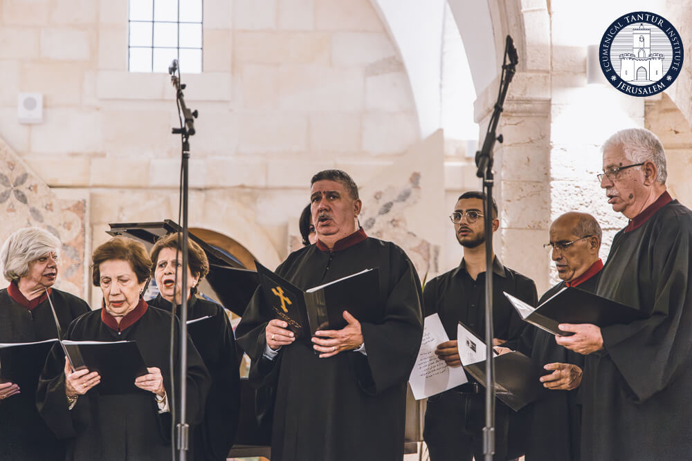
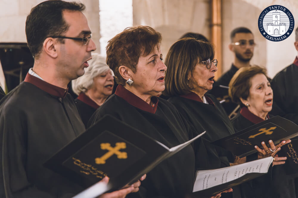
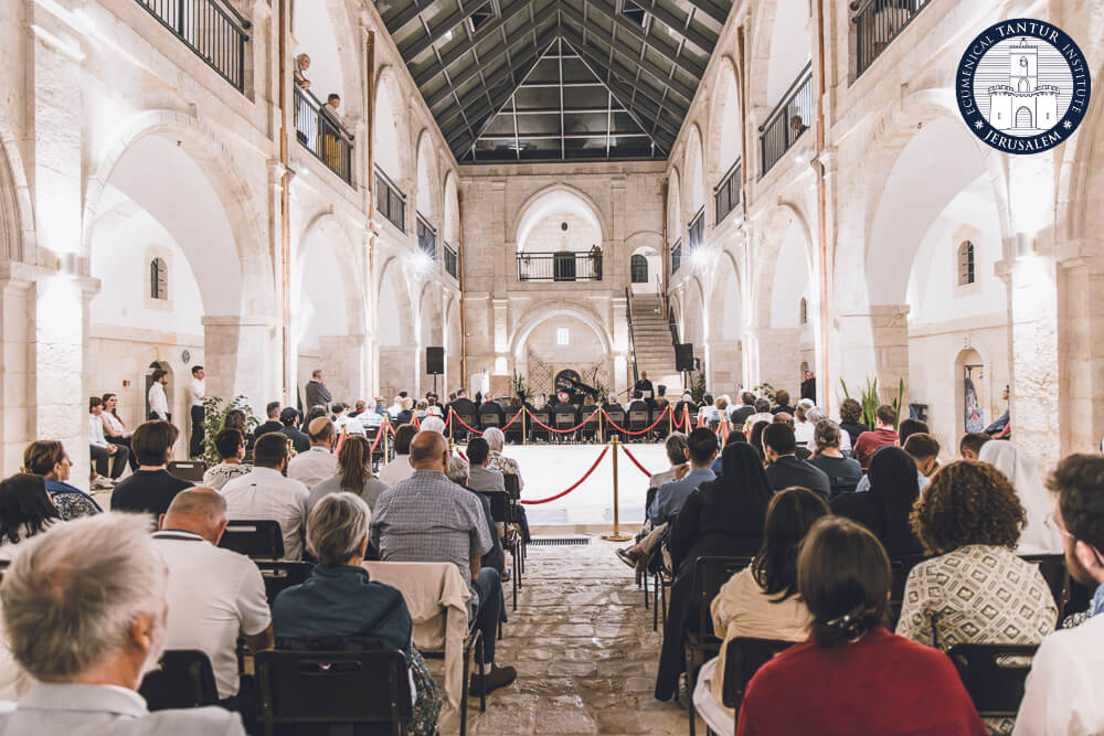
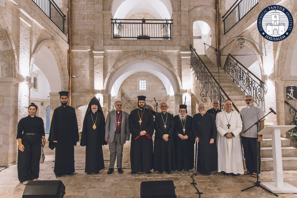
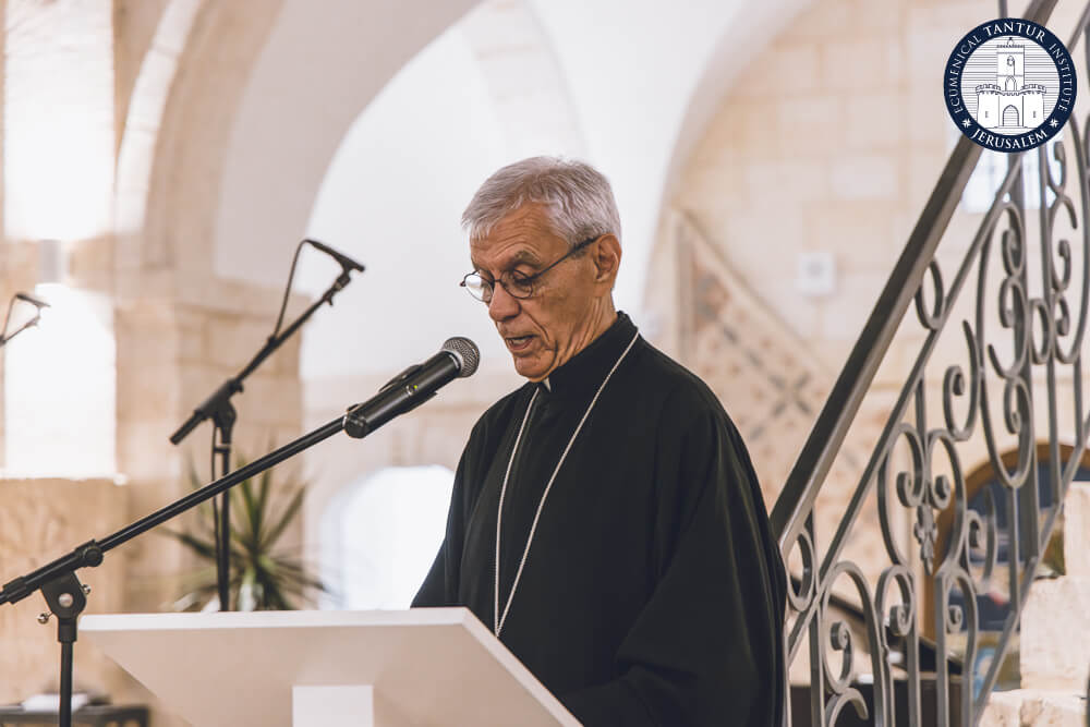
]]>Jerusalem — October 5, 2025. The Tantur Ecumenical Institute, together with the Focolare Movement and the Ecumenical Commission of the Catholic Church, and with the support of the Pontifical Mission and the Helen and Edward Mardigian Armenian Museum of Jerusalem of the Armenian Apostolic Patriarchate of Jerusalem, hosted an ecumenical concert commemorating the 1700th anniversary of the Council of Nicaea. The event was held at the Armenian Museum in Jerusalem, with more than 200 people in attendance.
Bringing together faithful and friends from across the city’s Christian communities, the program of sacred music and common prayer offered a living witness to the Nicene confession of faith and to the hope of visible Christian unity today.
Heartfelt thanks to the choirs who made this celebration possible: the Armenian Seminary of Jerusalem, the German Lutheran Church & Dormition Abbey, the Coptic Orthodox Church, the Syriac Orthodox and Syriac Catholic Churches, and the Greek Orthodox Church. Their voices, distinct yet harmonious, embodied the spirit of fellowship that the Council of 325 continues to inspire seventeen centuries later.
We are grateful to all who attended and to our partners and supporters whose collaboration made the evening possible. Your presence, and that of everyone who joined us, made the gathering truly unique. Thank you.
Photos: Nizar M. Halloun / Tantur Ecumenical Institute, 2025.
This designation not only highlights the site's historical and cultural significance but also grants it immediate access to emergency funding and technical support from UNESCO for preservation efforts.
Situated south of Gaza City, Tell Umm Amer dates back to the fourth century and features the remains of the monastery of Saint Hilarion. The site includes two churches, a burial area, a baptismal hall, a public cemetery, an audience hall, and dining facilities.
In its 2012 application to UNESCO's World Heritage Tentative List—an inventory of sites considered for inclusion—the Permanent Delegation of Palestine to UNESCO emphasized Tell Umm Amer’s importance in the early history of Christianity in Palestine.
"The monastery of Saint Hilarion is a unique site due to its exceptional architectural elements and its significant historical, religious, and cultural value. It was a key location at the crossroads of Egypt, Palestine, Syria, and Mesopotamia," the application noted.
The site is notably linked to the growth of monastic desert centers in Palestine during the Byzantine period. Saint Hilarion’s monastery may have served as a hub for missionary activity in the Gaza region, positioned at a critical crossroads despite its seemingly isolated desert location.
Since the outbreak of the Israel-Gaza conflict, over 200 of Palestine’s historical and archaeological sites have been damaged or destroyed, according to a statement from the Palestinian Ministry of Culture. This includes the 1,400-year-old Al Omari Mosque, Gaza’s oldest, which suffered significant damage during an Israeli military offensive, and the Hamam Al Sumara, Gaza’s last functioning bathhouse dating back to 1320.
Palestine now has four sites on the World Heritage List: the Church of the Nativity in Bethlehem, completed in 339; the village of Battir, known for its ancient olive groves and vineyards; and Tell es-Sultan (Ancient Jericho), which features archaeological deposits from as far back as 10,500 BC.
In addition to Gaza’s Tell Umm Amer, the World Heritage Committee is reviewing three other sites from a list of 28. These include Umm Al Jimal in Jordan, a city with Nabataean origins; the Al Faw archaeological area in Saudi Arabia, a once-thriving city from the fourth century BC to the fourth century AD; and Hegmataneh in Iran, one of the country's oldest inhabited cities with a history reaching back to the first millennium BC.
]]>The wreck, located nearly two kilometers (1.2 miles) deep and 90 kilometers off the Palestinian-Israeli coast, was found about a year ago. This unprecedented discovery raises questions about the navigational capabilities of ancient civilizations, suggesting either an accidental journey far from the coast or advanced seafaring skills previously unrecognized.
While many shipwrecks have been found on the seafloor, this is the earliest one from such a depth. Until now, it was uncertain whether ancient Mediterranean peoples deliberately ventured into the open sea or stayed close to the coastlines.
Jacob Sharvit, head of the IAA Marine Unit, noted that the ship seemed to have sunk suddenly, as evidenced by the intact arrangement of hundreds of pottery jars. The ship likely went down intact, descending to a depth of 1.8 kilometers (5,900 feet), where it remained undisturbed until Energean's sonar survey detected the anomaly.
A robot submersible confirmed the presence of ancient jars peeking through the sediment. The sudden sinking could have been caused by pirates or a structural failure, such as a leak in the bitumen sealing the wooden planks. "Whatever happened, it seems to have happened fast," Sharvit said, noting the absence of any attempts by the crew to lighten the vessel.
Initial identification of the ship as Canaanite was based on robot photographs. After months of planning, Energean deployed an ROV to recover two of the ancient pots about two weeks ago.
British company Energean is developing several Israeli fields, including Tanin ("crocodile") and Karish ("shark"), and fields for Egypt and other regions. The Orca field, off the Haifa coast, was being surveyed when the discovery was made.
Energean public affairs officer Eliana Fischler explained that their advanced submersible robot conducts thorough seabed surveys as part of their natural gas extraction activities. Dr. Karnit Bahartan, head of Energean's environmental unit, noted that they reported the anomaly to the Environment Ministry, Energy Ministry, and IAA as required by Israeli regulations.
Energean forwarded photos of the jars to Jacob Sharvit, who recognized their significance as Bronze Age artifacts. "I almost fell off my chair," he said, realizing the importance of the discovery.
The IAA then collaborated with Energean for a second ROV mission to extract samples from the site. Sharvit mentioned that the IAA does not possess a deep-sea submarine capable of reaching such depths and relied on Energean's technology to avoid risking human lives.
This remarkable find not only sheds light on ancient maritime history but also highlights the intersection of modern technology and archaeological discovery.
The documents of the Eastern Section of the DPCU include those of the Joint International Commission for Dialogue between the Catholic Church and the Oriental Orthodox Churches, the Joint International Commission for Dialogue between the Catholic Church and the Orthodox Church , and the Joint International Commission for Theological Dialogue between the Catholic Church and the Assyrian Church of the East.
The general documents are: Unitatis redintegratio - Decree on Ecumenism of the Second Vatican Council (1964); Directory for the Application of Principles and Norms on Ecumenism (1993); Ut unum sint - Encyclical Letter of Pope John Paul II on Ecumenical Commitment (1995); The Bishop and Christian Unity: Ecumenical Vademecum (2020)
The Dicastery for Promoting Christian Unity hopes that this translation into Arabic will facilitate the reception of these documents by the Churches, particularly in the Middle East.
The translation was coordinated by the Research Center of the Faculty of Religious Sciences of the St. Joseph University of Beirut.
]]>Regular fee: 430ドル - Student Fee: 390,ドル including lunches, basic material and tuition
Information : tanturpo@nd.edu
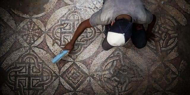
What was once an inconspicuous construction zone, surrounded by nondescript apartment buildings, has now transformed into a treasure trove for archaeologists eager to learn more about Gaza's rich history. Gaza, a coastal enclave inhabited by approximately 2.3 million people, has a historical legacy shaped by its position along ancient trade routes between Egypt and the Levant. However, the region's archaeological heritage has faced threats from various factors, including Israeli occupation, a 16-year rule by Hamas, and rapid urban development.
In this context, the initial discovery of 60 graves at the site in January was already a significant find. That number has now grown to 135, marking a major archaeological discovery, according to experts. René Elter, a French archaeologist leading the excavation, reported that over 100 of the graves have already been studied, providing valuable insights into the culture, health conditions, and ailments of the population.
Elter highlighted the lead sarcophagi, one adorned with intricate grape leaf motifs and the other featuring images of dolphins, as exceptional findings. These lead tombs are a first-of-their-kind discovery in Gaza, leading Palestinian archaeologists like Fadel Al-Otul to speculate that they might be the resting places of social elites. Historically, cemeteries were often located near city centers during Roman times.
In addition to the sarcophagi, Elter's team is diligently restoring unearthed skeletons and reconstructing fragments of clay jars. The skeletal remains discovered at the site are slated for further analysis outside of Gaza, with the results returning to the Hamas-led Ministry of Antiquities and Tourism.
Elter stressed the need for a dedicated team to oversee archaeological activities in Gaza, emphasizing that the people of Gaza deserve the opportunity to tell their stories. Gaza holds significant potential for further archaeological discoveries, but given the rapid pace of development, monitoring and preserving these sites present considerable challenges.
]]>According to UNESCO, the site's historical significance lies in its emergence as a permanent settlement between the 9th and 8th millennia BC, owing to the fertile oasis soil and easy access to water. This oval-shaped mound has yielded evidence of one of humanity's earliest known villages and a significant Bronze Age town dating back to 2,600 BC.
Located approximately 2 kilometers (1.2 miles) from the remains of Jericho's first city, the site is replete with historical treasures. This includes ruins of significance to Jewish history, such as a synagogue dating back to the first century BC. Jericho itself ranks among the oldest continuously inhabited cities globally and is located in an area of the Israeli-occupied West Bank administered by the internationally recognized Palestinian Authority.
Israel has strongly condemned the UNESCO decision, characterizing it as a "cynical ploy." The foreign ministry of Israel expressed its disapproval and vowed to work with like-minded nations within the organization to challenge the decision. It's worth noting that Israel withdrew from UNESCO in 2019, alleging an anti-Israel bias, but did participate in the latest meeting held in Saudi Arabia.
The West Bank, along with Gaza and east Jerusalem, was captured by Israel in the 1967 Middle East conflict. Palestinians aspire to have all three territories as part of their future state. However, with over a decade passing since any substantial peace negotiations, the prospects for Palestinian statehood remain uncertain, given the current leadership in Israel.
Throughout the Israeli-Palestinian conflict, historical heritage has been a contentious issue. Both sides have employed archaeology and conservation to assert their unique connections to the Holy Land. The Palestinian Authority, recognized as a non-member observer state by the United Nations a decade ago, welcomed the designation of Tell es-Sultan as a World Heritage Site. PA President Mahmoud Abbas emphasized that it "testifies to the authenticity and history of the Palestinian people" and pledged to preserve the site for the benefit of all humanity.
Tell es-Sultan, located in the Jordan Valley, is believed to predate Egypt's pyramids and features an oval-shaped mound containing prehistoric deposits and artifacts. Notably, it is considered one of the oldest fortified cities globally, with skulls and statues discovered on the site. The site boasts a Neolithic-era tower with an internal stairway dating back at least to 8,000 BCE. Bronze Age archaeological findings indicate signs of urban planning, while Roman-era remnants include a wine press and pre-Neolithic pottery.
Additionally, the site is home to Hisham's Palace mosaic, an Umayyad castle from the mid-eighth century. This palace, constructed during the rule of Umayyad Caliph Hisham ibn Abdul Malik, stands out for its intricate structural design and elaborate interiors, drawing inspiration from the region's pre-Islamic Byzantine rulers.
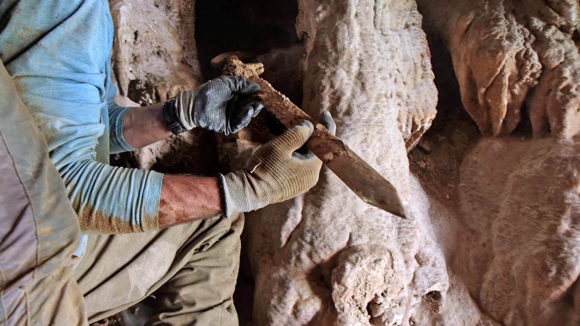
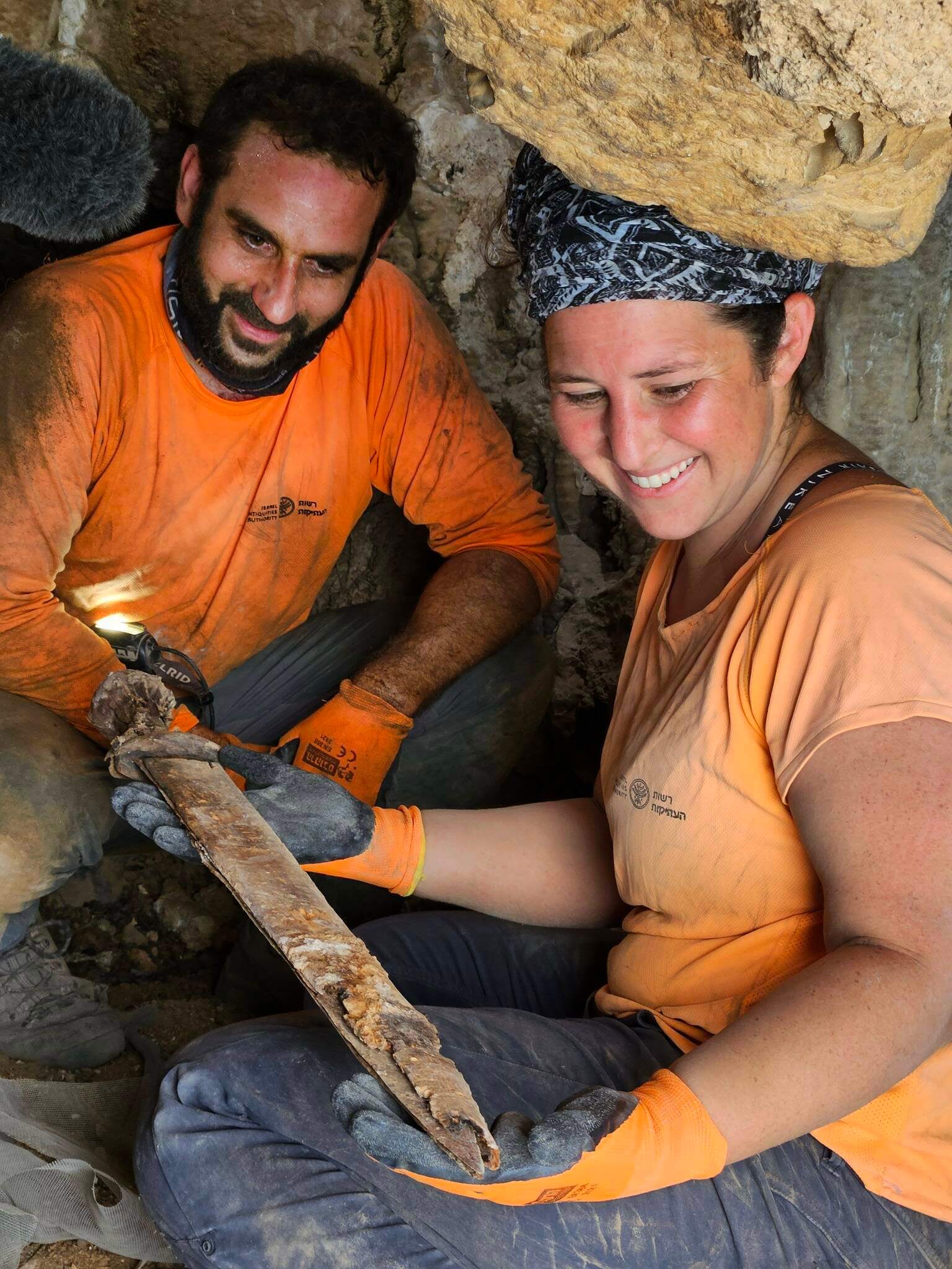
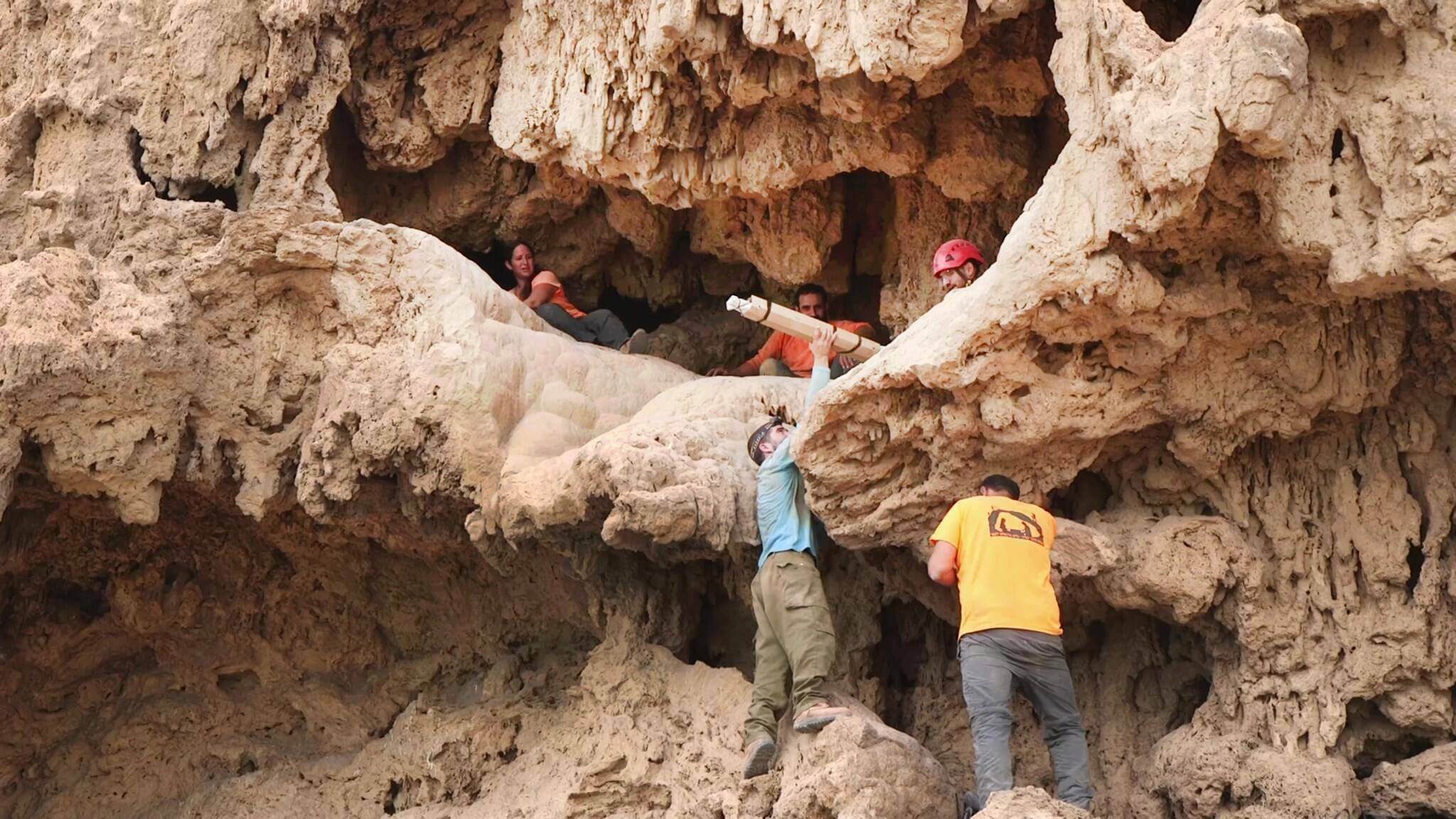
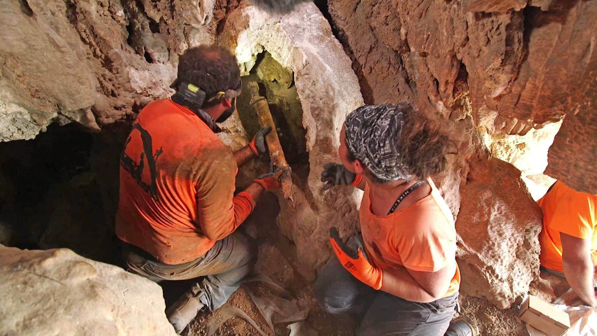
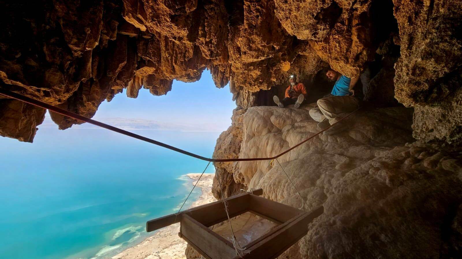
]]>The discovery occurred in June within Israel's En Gedi Nature Reserve, an area rich in caves with a history spanning over 10,000 years. Researchers from Ariel University and Hebrew University were initially drawn to the cave to document an ancient inscription. Still, they stumbled upon the swords when they noticed an iron point and pieces of worked wood. The Israel Antiquities Authority's Judean Desert Survey Project subsequently returned to the site and located the swords in an unexplored section of the cave.
The swords, possibly dating from the 1st to the 3rd century A.D., include three Roman spathas, double-edged longswords used by both cavalry and infantry, and one with a unique metal ring pommel. These weapons provide valuable insights into the tumultuous times when Roman troops clashed with Jewish rebels in the region. While the Bar Kokhba revolt of 132 to 136 A.D. is a candidate for the event that led to the swords' concealment, other historical events are also plausible.
Radiocarbon dating results are pending, but the exceptional preservation of these swords offers a rare opportunity to study ancient technology. Experts plan to analyze the wood and leather to determine their origins and employ CT scans and X-rays to examine construction details. This discovery promises to shed light on the manufacturing techniques of swords in the Eastern Roman Empire, a lesser-known aspect of Roman history.
For researchers in Israel, this is just the beginning of a multi-year study to unravel the cave's secrets and the swords' history. The find underscores the importance of preserving archaeological sites across the region, as looters could have deprived us of this remarkable historical knowledge.
]]>An impressive archaeological find has unveiled the remains of a Roman military amphitheater near Tell Megiddo, shedding light on the historical significance of the region. The amphitheater, a prominent archaeological site in the Jezreel Valley, belonged to the Roman legion camp known as Legio. This camp, housing over 5,000 soldiers, served as the home for Legio II Triana and later, the formidable Legio VI Ferrata, also known as the Ironclad Legion. Notably, it stands as the sole known full-scale legionary base of its kind in the eastern territories of the Roman Empire, dating back to the second century C.E.
The rediscovery of the camp took place during a survey in the early 2000s. Recently, during the summer excavation season of 2023, archaeologists have been delving into its various components, including the principia (central control center), cemetery, and the amphitheater.
This amphitheater, distinguished by its distinctive oval shape carved into the bedrock, is far from a conventional arena for entertainment. Instead, it served as a training ground for soldiers and potentially gladiators, enabling them to hone their combat skills with weaponry and armor. The walls surrounding the arena were notably painted a striking blood-red, creating an imposing atmosphere.
The archaeological team, co-led by Dr. Yotam Tepper and Dr. Matthew Adams, undertook these excavations in collaboration with the Jezreel Valley Regional Project, the Albright Institute in Jerusalem, the Israel Antiquities Authority, and funding from American Archaeology Abroad. The endeavor was informed by advanced ground-penetrating radar technology from Sweden, allowing researchers to identify hidden features beneath the ground's surface.
The investigations uncovered two distinct phases of the amphitheater's construction, suggesting an earlier, smaller structure followed by a later, expanded version. Positioned adjacent to the camp, this amphitheater served a dual purpose: training ground and potential venue for entertainment. Its strategic location near the camp cemetery indicates its multifunctional nature.
The ongoing excavations have unveiled significant sections of the camp's layout, even though it has suffered from extensive stone theft over the centuries. The principia, which functioned as the central hub of command, showcased well-preserved walls, alongside a sacred space known as the sacellum.
A notable artifact discovered within the sacellum is a fragment of a statue featuring three toes, possibly belonging to a deified Roman emperor. This find offers a glimpse into the religious practices and veneration of emperors that took place within the camp.
As researchers progress in their explorations, the site could become a fascinating tourist attraction, providing insights into the training and activities of Roman soldiers. However, plans to reroute a portion of the Route 66 highway through the area raise concerns about the preservation of this unique archaeological site. Some experts advocate for the construction of the highway to proceed, leaving a portion of the camp unexcavated for future generations equipped with more advanced archaeological techniques.
The ongoing discoveries at Legio offer a captivating glimpse into the military and cultural history of the region, revealing the complex interplay between training, worship, and daily life within a Roman legion camp.
]]>Download here: Unity Week 2023
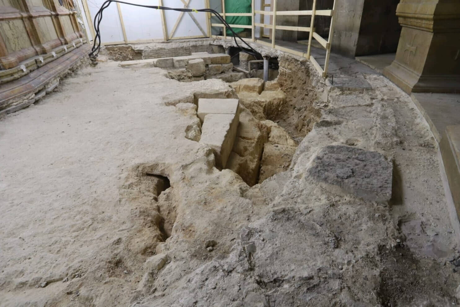
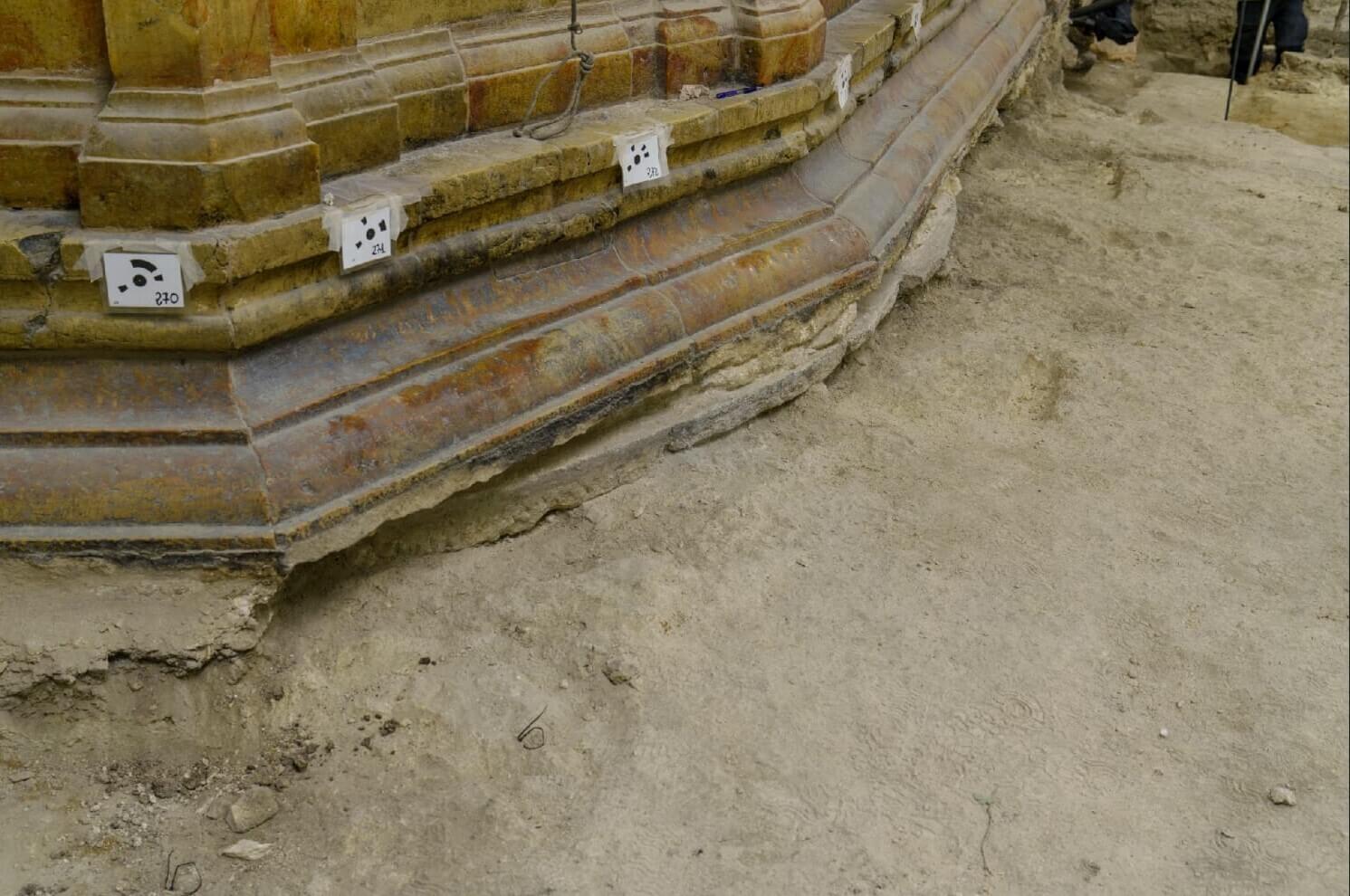
]]>After having excavated the area of the Arch of the Virgin as well as the northern and intermediate part of the Rotunda, the archaeologists of the Department of Antiquities of the Sapienza University of Rome are now concentrating on its southern half, compelling the Copts to move their chapel, made inaccessible, in a prefabricated structure.
And under the slabs, the bedrock of the stone quarry used for public crucifixions which is revealed: "The traces of the wedges and cuts used to detach the stones, often very large, are clearly visible", explains the Professor Francesca Romana Stasolla in a statement issued by the Custody of the Holy Land on January 15th.
As a result, these cuts create large holes: "The depth of the quarry varies from a few centimeters to more than two meters in places," continues the archaeologist. Holes, on which Emperor Hadrian (117-138 AD) had a temple built, the foundations of which are revealed once the paving stones have been removed. These Roman structures were already discovered during excavations carried out in 1974 by Charles Couasnon and documented by the Franciscan Virgilio Corbo. "Exploring this area again allows us to update the documentation and better connect it to new archaeological data," explains Francesca Romana Stasolla.
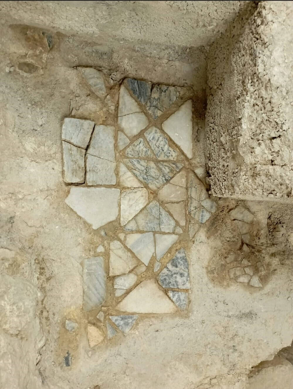
Current excavations also shed light on the evolution of the place. In the first decades of the 4th century, at the instigation of the Emperor Constantine, Hadrian's temple was destroyed and the area razed: "The rock was cut down to the base of the tomb, identified as that of Christ and dug into the hill, to create a flat area. Remains of the first monument built around the tomb have been found under the current aedicula: it is a circular floor in reused marble, carefully worked, the circumference of which includes the entire surface of the tomb", explains the specialist before insisting: "Even the oldest representations of the tomb show a circular monument."
The remains of two floors, made using the opus sectile technique (assembly of marble slabs to create geometric shapes) were unearthed. The oldest uses white and gray marble slabs, laid directly on the rock. Charles Couasnon already found part of it in the 1970s. The other, more recent, was made from reused marble.
Analyzes and research will continue for a total of 26 months. Ten areas will be excavated successively to allow the regular performance of liturgies by the different denominations and the normal flow of pilgrims.
Source: Article by Cécile Lemoine for terresainte.net
Original title: Au Saint-Sépulcre, les pavés en dévoilent d’autres
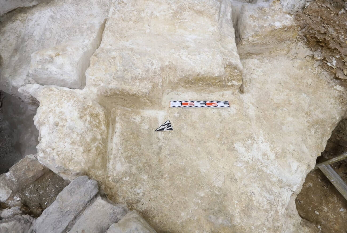
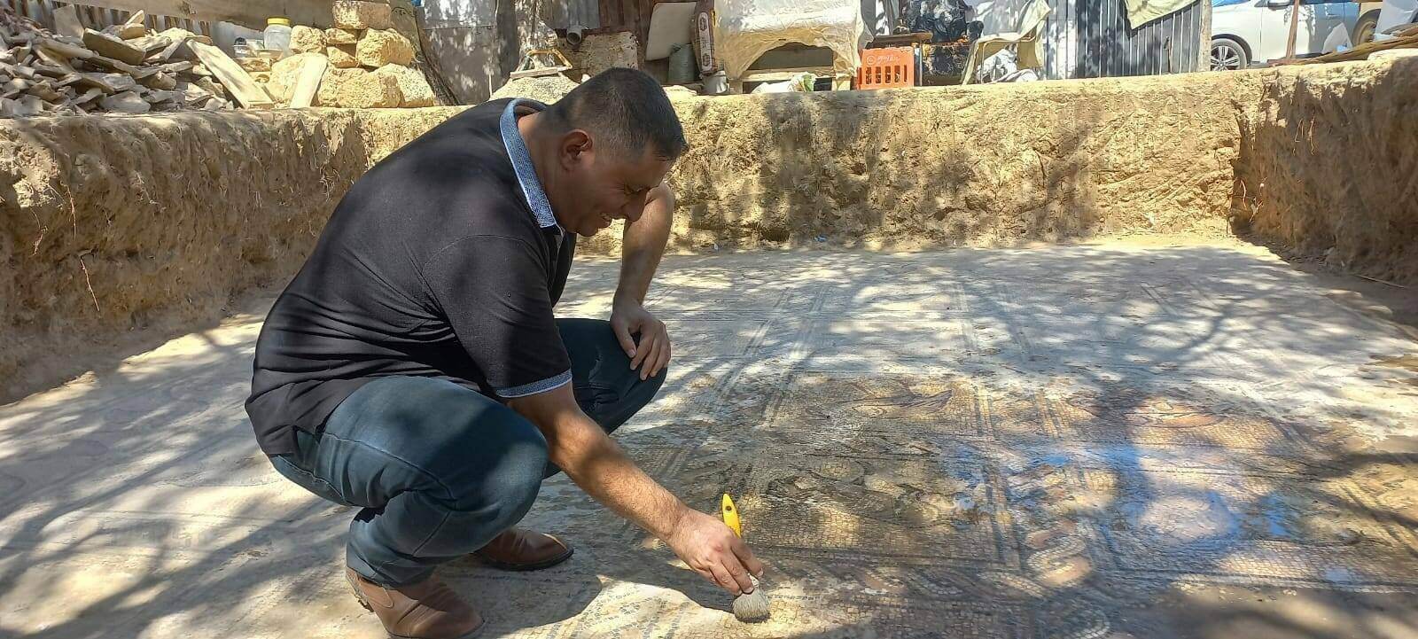
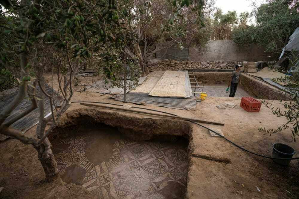
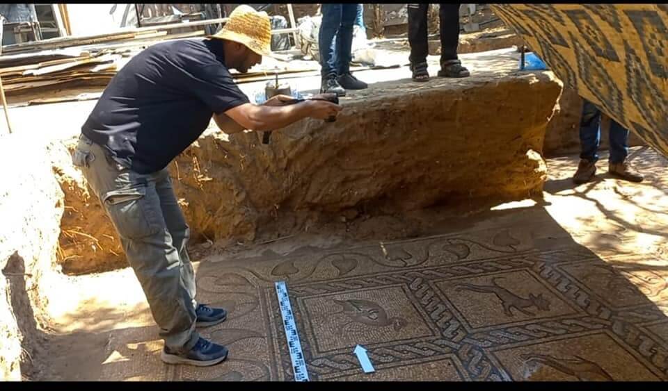
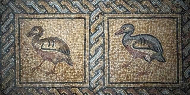
]]>Mosaics dating from the 5th to 7th centuries were unearthed by farmers in Gaza refugee camp in an orchard in the central Gaza Strip. They were discovered by Palestinian farmer Salman al-Nabahin and his son as they were planting an olive tree on their land last spring.
Although parts of the mosaic had been damaged by the roots of old olive trees, these brightly colored mosaics featuring 17 iconographies of beasts and birds are "in perfect state of conservation", declared Elter, adding that it is "the most beautiful mosaic floor" found in Palestine.
"This is a first: on the one hand, this mosaic is very beautiful for the finesse of the work and on the other hand, it is exceptional because it is in a state of conservation that we do not have elsewhere in Gaza. added Elter, whose team examined the discovery.
"It is a work of excellent quality, they used materials that were certainly relatively expensive," said the French archeologist, noting the "shimmering colors" of the work, which he estimates dates from the 5th to the 7th century.
But Elter expressed concern that the discovery is in "immediate danger" because its closeness to the Israeli fence. "It is imperative to quickly organize an emergency rescue intervention," he says.
In January, construction workers discovered the remains of a 2,000-year-old Roman necropolis in Jabalia, in the north of the Palestinian enclave with a population of 2.3 million.
]]>9:30-11:30 The Oriental Churches in Jerusalem, Fr. Frans Bowen
14:00-16:00 Ecumenism in Holy Land, Fr. Frans Bowen
Morning: Encountering the Coptics and Syriacs in Jerusalem
17:30 Taizé Prayer in Tantur’s Chapel
19:00 Tuesdays at Tantur Lecture
10:00-16:00 Encountering the Greek and Armenian Orthodox (Armenian Vespers at St James Cathedral at 15:00)
17:30 Taizé Prayer in Tantur’s Chapel
7:30-15:00 A Judean Desert Excursion
9:00-12:00 Encountering the Latin Patriarchate, the Melkites, and the Lutherans
Their History and Presence in the Holy Land
17:00 Taizé Prayer in Tantur’s Chapel
All events are free of charge upon reservation: tanturpo@nd.edu
]]>"I am restrained in what I can say about the results, but I will say that there will be a small earthquake in the Christian world. I could be mistaken, but I think the results will be seen as one of the most important discoveries for New Testament archaeology in this century," Steven Notley, Academic Director of Excavations, announced in a suspenseful blog post dated August 8, the last day of the sixth excavation campaign at the site of el-Araj, located on the northern shore of Sea of Galilee.
A few days later, the discovery was made public: a large 1500 years old Greek inscription has been unearthed in the Byzantine basilica, which archaeologists from Kinneret College, in charge of excavations at the el-Araj site since 2014, call "the Church of the Apostles".
Following the Byzantine tradition of dedicatory mosaics, the inscription begins by naming the donor, a so called "Constantine, the servant of Christ" (not Constantine the Great), before proceeding to the thilling part: a request for intercession to the "chief and commander of the heavenly apostles ". A title "commonly used by Byzantine Christians to refer to the Apostle Peter," clarifies the statement.
So framed by a round medallion made up of two lines of black tesserae, the inscription is part of a larger mosaic floor located in the diaconicon (namely a sacristy) of the church and decorated with floral patterns. "This discovery is our strongest indicator that the basilica had a special association with St. Peter, and it was likely dedicated to him. Since Byzantine Christian tradition routinely identified Peter and Andrew’s home in Bethsaida, it seems likely that the basilica commemorates their home," explains Notley.
According to the hypotheses of archaeologists, the church could cover the remains of the house of Peter and Andrew, disciples of Jesus from Bethsaida, a city mentioned in the Bible, which has since been lost. "The Byzantine Christian tradition regularly identifies the house of Peter with Bethsaida, and not with Capernaum as is often thought today", continues Notley.
In the first century, Bethsaida was a small, unpretentious fishing port. It acquires the status of polis by the hand of Philip the Tetrarch, governor of the region in 30 AD and was named "Julias". The Gospel relates that in addition to having seen the birth of several of the disciples, Bethsaida witnessed the miracle of the healing of the blind man, before being condemned by Jesus for his lack of faith.
It is a certain St. Willibald, a Bavarian bishop on a pilgrimage to the Holy Land in the eighth century. who was the first to mention the existence of a church on the site built over the house of St. Peter and Andrew. While traveling from Capernaum to Kursi, he spent the night in a place he was told was Bethsaida, where Peter and Andrew came from. "There is now a church where their home used to be," says his Hodoeporicon, Willibald’s itinerary in the Holy Land. For Notley, the discovery of the large Greek inscription "confirms the testimony of the eighth century Bishop Willibald, who visited the church, that Christianity in the Byzantine period commemorated the house of St. Peter at Bethsaida and not at Capernaum".
Taken together, these finds continue to strengthen the identification of el-Araj with ancient Bethsaida, but do not constitute conclusive evidence as to the exact location of the house of Peter and Andrew. During the next excavation season in October, the archaeologists hope to find an inscription dedicated to Andrew.
]]>